|
search place name
|
||
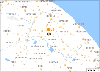
Wuli (Zhejiang, China)Wuli is a town in the Zhejiang region of China. An overview map of the region around Wuli is displayed below.
regional and 3d topo map of Wuli, China ::
Wuli airports ::
The nearest airport is NGB - Ninbo Lishe, located 38.1 km south of Wuli.
Other airports nearby include HGH - Hangzhou Xiaoshan (91.1 km west), SHA - Shanghai Hongqiao Intl (114.9 km north), Nearby towns ::
Fushan (1.1km east) //
Maojia (2.2km north west) //
Qiaotou (2.2km south west) //
Gangtou (2.5km south) //
Xiaolingfeng (2.7km north) //
Guancheng (2.5km north east) //
Minghe (3.1km south) //
Chetou (2.9km west) //
Sanguan (3.2km north west) //
Tanheyan (3.3km north west) //
Banhengli (3.7km north) //
Wubi (4.0km north) //
Xiaotangtou (3.6km west) //
Wayaotou (4.3km south) //
Shiqiaozhen (3.8km east) //
Donghetou (3.8km south west) //
Tianyuanshi (4.3km north) //
Dongshantou (4.6km north east) //
Yanpu (4.5km south east) //
Mijiadai (5.2km south) //
Damin'ao (5.3km south) //
Longwangtang (4.9km north east) //
Fangjia (4.7km east) //
Dongluo (4.8km south east) //
Shanqianpu (5.3km north east) //
Sanjie (5.6km north) //
Linjia (5.2km north east) //
Taiyangdi (5.9km north) //
Xiaolinzhen (5.4km north west) //
[all distances 'as the bird flies' and approximate] 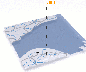 Places with similar names to Wuli, China ::
Disclaimer :: Information on this page comes without warranty of any kind |
||
|
Where is Wuli? Elevation and coordinates ::
Latitude (lat): 30°9'44"N Longitude (lon): 121°22'39"E
Elevation (approx.): 7m (map arrows pan, magnifying glasses zoom) |
||
|
Visiting Wuli? Hotel/Accommodation ::
Book a hotel in Wuli Travel Guide ::
Buy a travel guide for China rental cars ::
car rental offers GPS waypoint ::
download a GPX waypoint (PoI) of Wuli for your GPS receiver
|
||