|
search place name
|
||
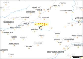
Xiangshi (Anhui, China)Xiangshi is a town in the Anhui region of China. An overview map of the region around Xiangshi is displayed below.
regional and 3d topo map of Xiangshi, China ::
Xiangshi airports ::
The nearest airport is HFE - Hefei Luogang, located 175.8 km north of Xiangshi.
Other airports nearby include KHN - Nanchang Changbei Intl (200.9 km south west), NKG - Nanjing Lukou (226.9 km north east), Nearby towns ::
Beishan (2.8km west) //
Xikeng (3.7km south) //
Dingxiang (4.1km east) //
Xiataochong (4.8km north) //
Zhangcun (6.2km north) //
Shentian (5.7km west) //
Danankeng (7.2km south) //
Xiaohezhen (7.4km north) //
Wudun (6.7km south east) //
Xiaohe (8.1km north) //
Xiahushan (8.3km north west) //
Shaxilong (7.9km north west) //
Liyang (8.8km north) //
Pancun (8.3km south east) //
Gaoshan (8.3km south west) //
Chayuanli (9.9km south west) //
Bitan (9.9km south east) //
[all distances 'as the bird flies' and approximate]  Places with similar names to Xiangshi, China ::
// Saingshe (MM)
// Sangaichi (MM)
// Sengach (DE)
// Sungai Chua (MY)
// San Acacia (US)
// Sankishia (CD)
// Zangasia (CD)
// Sānkchi (IN)
// Sonkach (IN)
// Sonkach (IN)
Disclaimer :: Information on this page comes without warranty of any kind |
||
|
Where is Xiangshi? Elevation and coordinates ::
Latitude (lat): 30°11'40"N Longitude (lon): 117°18'30"E
Elevation (approx.): 81m (map arrows pan, magnifying glasses zoom) |
||
|
Visiting Xiangshi? Hotel/Accommodation ::
Book a hotel in Xiangshi Travel Guide ::
Buy a travel guide for China rental cars ::
car rental offers GPS waypoint ::
download a GPX waypoint (PoI) of Xiangshi for your GPS receiver
|
||