|
search place name
|
||
Xindian (Jiangsu, China)Xindian is a town in the Jiangsu region of China. An overview map of the region around Xindian is displayed below.
regional and 3d topo map of Xindian, China ::

Xindian airports ::
The nearest airport is SHA - Shanghai Hongqiao Intl, located 125.5 km south of Xindian.
Nearby towns ::
Nangang (1.6km north west) //
Tangyuan (2.4km north west) //
Wuyao (3.8km south) //
Feijiayao (3.8km south) //
Shuichanyangzhichang (4.9km south west) //
Yunlong (4.9km north west) //
Xianggangqiao (5.1km south east) //
Luanjiadian (5.1km west) //
Huashijie (6.5km south east) //
Xifang'an (6.8km south) //
Xinlian (6.2km south west) //
Sanyao (6.7km south east) //
Chanan (7.0km north) //
Changhetan (7.5km south) //
Yuanjiayao (7.1km north east) //
Zhumu (8.5km north west) //
Shuangnan (8.4km north west) //
Shengpu (8.2km north west) //
Songjiadian (8.4km south west) //
Sanjiaochi (9.3km south) //
Shinan (10.4km south east) //
[all distances 'as the bird flies' and approximate] 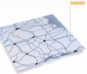 Places with similar names to Xindian, China ::
Disclaimer :: Information on this page comes without warranty of any kind |
||
|
Where is Xindian? Elevation and coordinates ::
Latitude (lat): 32°16'0"N Longitude (lon): 120°54'0"E
Elevation (approx.): 3m (map arrows pan, magnifying glasses zoom) |
||
|
Visiting Xindian? Hotel/Accommodation ::
Book a hotel in Xindian Travel Guide ::
Buy a travel guide for China rental cars ::
car rental offers GPS waypoint ::
download a GPX waypoint (PoI) of Xindian for your GPS receiver
|
||