|
search place name
|
||
Xinfeng (Jiangxi, China)Xinfeng is a town in the Jiangxi region of China. An overview map of the region around Xinfeng is displayed below.
regional and 3d topo map of Xinfeng, China ::

Xinfeng airports ::
The nearest airport is KHN - Nanchang Changbei Intl, located 195.7 km north of Xinfeng.
Nearby towns ::
Longyuan (5.7km south) //
Jieshang (6.8km west) //
Shapingshang (6.9km east) //
Huangbailing (7.7km north west) //
Xinggong'ao (8.9km south west) //
Xixi (9.0km south east) //
Shakeng (10.8km south east) //
[all distances 'as the bird flies' and approximate] 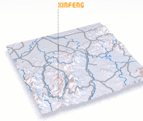 Places with similar names to Xinfeng, China ::
// Suan Phung (TH)
// Songhang (KP)
// Sanghŭng (KR)
// Sanfeng (CN)
// Hsin-feng (TW)
// Sen Phương (VN)
// Song Hồng (VN)
// Sanfang (CN)
// Sanfang (CN)
// Sanfeng (CN)
Disclaimer :: Information on this page comes without warranty of any kind |
||
|
Where is Xinfeng? Elevation and coordinates ::
Latitude (lat): 27°7'0"N Longitude (lon): 116°11'0"E
Elevation (approx.): 257m (map arrows pan, magnifying glasses zoom) |
||
|
Visiting Xinfeng? Hotel/Accommodation ::
Book a hotel in Xinfeng Travel Guide ::
Buy a travel guide for China rental cars ::
car rental offers GPS waypoint ::
download a GPX waypoint (PoI) of Xinfeng for your GPS receiver
|
||