|
search place name
|
||
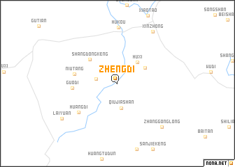
Zhengdi (Fujian, China)Zhengdi is a town in the Fujian region of China. An overview map of the region around Zhengdi is displayed below.
regional and 3d topo map of Zhengdi, China ::
Zhengdi airports ::
The nearest airport is XMN - Xiamen Gaoqi, located 160.5 km south east of Zhengdi.
Other airports nearby include KNH - Chinmen Shang Yi (185.8 km south east), Nearby towns ::
Xiaodi (3.1km west) //
Qiujiashan (4.0km south) //
Huxi (4.5km north east) //
Yuanling (4.6km north east) //
Shangdongkeng (5.5km north west) //
Niutang (6.3km west) //
Guodi (6.5km west) //
Huangdi (7.2km south west) //
Zhanggonglong (9.4km south east) //
Xinzhong (9.7km north east) //
Laiyuan (9.8km south west) //
[all distances 'as the bird flies' and approximate] 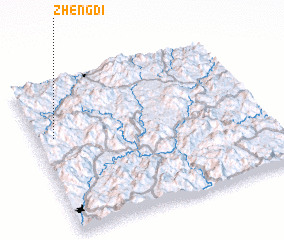 Places with similar names to Zhengdi, China ::
// Zhongdu (CN)
// Şahinçatı (TR)
// Zhangdi (CN)
// Xiahongdao (CN)
// Xiaohengdu (CN)
// Xiaohengdu (CN)
// Xiaohuangdi (CN)
// Zhangda (CN)
// Zhangde (CN)
// Zhangdu (CN)
Disclaimer :: Information on this page comes without warranty of any kind |
||
|
Where is Zhengdi? Elevation and coordinates ::
Latitude (lat): 25°38'2"N Longitude (lon): 117°4'46"E
Elevation (approx.): 650m (map arrows pan, magnifying glasses zoom) |
||
|
Visiting Zhengdi? Hotel/Accommodation ::
Book a hotel in Zhengdi Travel Guide ::
Buy a travel guide for China rental cars ::
car rental offers GPS waypoint ::
download a GPX waypoint (PoI) of Zhengdi for your GPS receiver
|
||