|
search place name
|
||
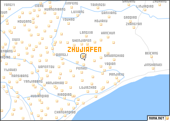
Zhujiafen (Zhejiang, China)Zhujiafen is a town in the Zhejiang region of China. An overview map of the region around Zhujiafen is displayed below.
regional and 3d topo map of Zhujiafen, China ::
Zhujiafen airports ::
The nearest airport is SHA - Shanghai Hongqiao Intl, located 53.0 km north of Zhujiafen.
Other airports nearby include HGH - Hangzhou Xiaoshan (91.2 km south west), NGB - Ninbo Lishe (104.8 km south), Nearby towns ::
Xujiabang (0.9km north west) //
Xincangzhen (1.0km south) //
Zhuangjiabang (1.4km north) //
Sunjiazhaiji (1.5km west) //
Majiazhaiji (1.8km east) //
Fenwei (2.7km south) //
Xinmiao (2.6km north east) //
Wuhaoqiao (3.0km north) //
Xinfuhe (2.9km north west) //
Zhuangwei (3.6km north) //
Yaojiafen (3.1km east) //
Shenjiafen (3.6km north) //
Yangkou (3.3km south east) //
Zhangjiatang (3.6km south west) //
Yangjiafen (3.9km north west) //
Sanchahezhen (4.1km south east) //
Zhaojiaqiao (4.1km south west) //
Gaojiaqiao (4.5km south) //
Zhaojiawei (4.5km north east) //
Niu'ezhao (4.4km south east) //
Sangyuanli (4.2km west) //
Xujiazhaiji (4.3km south east) //
Qiangli (4.4km west) //
Langxia (5.4km north) //
Luwanmiao (4.7km east) //
Huangjiabang (5.1km north west) //
Zhoujiafen (5.4km south) //
Qinggangqiaodong (5.4km north east) //
Yaqian (5.1km east) //
[all distances 'as the bird flies' and approximate] 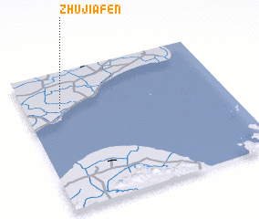 Places with similar names to Zhujiafen, China ::
// Zhoujiafen (CN)
// Zhujiafen (CN)
Disclaimer :: Information on this page comes without warranty of any kind |
||
|
Where is Zhujiafen? Elevation and coordinates ::
Latitude (lat): 30°44'23"N Longitude (lon): 121°10'47"E
Elevation (approx.): 7m (map arrows pan, magnifying glasses zoom) |
||
|
Visiting Zhujiafen? Hotel/Accommodation ::
Book a hotel in Zhujiafen Travel Guide ::
Buy a travel guide for China rental cars ::
car rental offers GPS waypoint ::
download a GPX waypoint (PoI) of Zhujiafen for your GPS receiver
|
||