|
search place name
|
||
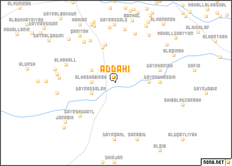
Aḑ Ḑaḩī (Al Ḩudaydah, Yemen)Aḑ Ḑaḩī is a town in the Al Ḩudaydah region of Yemen. An overview map of the region around Aḑ Ḑaḩī is displayed below.
regional and 3d topo map of Aḑ Ḑaḩī, Yemen ::
Aḑ Ḑaḩī airports ::
The nearest airport is GIZ - Gizan King Abdullah Bin Abdulaziz, located 193.6 km north of Aḑ Ḑaḩī.
Nearby towns ::
Dāwūdīyah (2.5km north east) //
Al Ḩashābirah (3.8km west) //
Dayr as Salām (4.2km south west) //
Dayr ‘Umar (4.3km north west) //
Dayr ash Shu‘bah (5.1km east) //
Bayt al Faqīh (6.1km north) //
Al Ma‘rūfīyah (6.3km north) //
Dayr Muḩassim (6.9km east) //
Dayr Ḩarish (7.2km east) //
Dayr Shuwayl (7.8km south west) //
Dayr ‘Ayyāsh (7.9km north west) //
Dayr ‘Umar (8.2km north west) //
Muţālibīyah (8.5km north) //
Al Maḩall (8.3km west) //
Dayr Ghurāb (8.7km north) //
Ash Sharīj (9.3km north east) //
Qarīyah (9.4km north west) //
Al Mikhdāsh (10.1km north east) //
Jarābiḩ (10.1km south west) //
Al Ḩashābirah (10.2km north west) //
Maḩall Ḩusayn al ‘Āqil (10.9km south west) //
[all distances 'as the bird flies' and approximate]  Places with similar names to Aḑ Ḑaḩī, Yemen ::
Disclaimer :: Information on this page comes without warranty of any kind |
||
|
Where is Aḑ Ḑaḩī? Elevation and coordinates ::
Latitude (lat): 15°12'55"N Longitude (lon): 43°4'8"E
Elevation (approx.): 79m (map arrows pan, magnifying glasses zoom) |
||
|
Visiting Aḑ Ḑaḩī? Hotel/Accommodation ::
Book a hotel in Aḑ Ḑaḩī Travel Guide ::
Buy a travel guide for Yemen rental cars ::
car rental offers GPS waypoint ::
download a GPX waypoint (PoI) of Aḑ Ḑaḩī for your GPS receiver
|
||