|
search place name
|
||
Ad Danabah (Yemen)Ad Danabah is a town in Yemen. An overview map of the region around Ad Danabah is displayed below.
regional and 3d topo map of Ad Danabah, Yemen ::
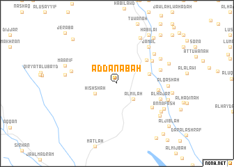
Nearby towns ::
Al Milāḩ (3.6km south east) //
Ḩishshah (3.8km south west) //
As Sawdāʼ (5.3km east) //
Ar Rawayd (5.9km north east) //
Adh Dhanīb (6.5km north east) //
Ash Sharj (6.5km east) //
Ar Raqqah (6.7km south east) //
Al Ḩawţah (7.1km east) //
Al Ḩajar (7.3km east) //
Shi‘b ad Dīwān (7.4km north east) //
Ar Rakoab (7.4km west) //
Jamal (7.7km north east) //
Mashrabah (7.9km north east) //
Al Qash‘ah (8.0km east) //
Al Ma‘āmir (8.2km north east) //
Al Aslamah (8.2km west) //
Sayfar (8.2km south east) //
An Nafash (8.4km south east) //
Ḩayd al Abyaḑ (8.5km south east) //
Al Kharibah (8.4km east) //
Ma‘ārif (8.6km west) //
Nuqayr (8.7km east) //
Kash al Harami (8.7km east) //
Habilai (9.2km north east) //
Al ‘Ulūb (9.2km north east) //
Al Ḩamrāʼ (9.2km north east) //
Ath Thumayr (9.2km north east) //
Masn‘ah (9.9km north west) //
Al Milāḩ (10.3km north east) //
[all distances 'as the bird flies' and approximate] 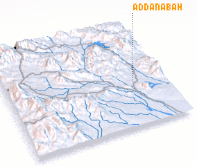 Places with similar names to Ad Danabah, Yemen ::
Disclaimer :: Information on this page comes without warranty of any kind |
||
|
Where is Ad Danabah? Elevation and coordinates ::
Latitude (lat): 13°26'50"N Longitude (lon): 44°48'14"E
Elevation (approx.): 562m (map arrows pan, magnifying glasses zoom) |
||
|
Visiting Ad Danabah? Hotel/Accommodation ::
Book a hotel in Ad Danabah Travel Guide ::
Buy a travel guide for Yemen rental cars ::
car rental offers GPS waypoint ::
download a GPX waypoint (PoI) of Ad Danabah for your GPS receiver
|
||