|
search place name
|
||
Al Huwayb (‘Adan, Yemen)Al Huwayb is a town in the ‘Adan region of Yemen. An overview map of the region around Al Huwayb is displayed below.
regional and 3d topo map of Al Huwayb, Yemen ::

Nearby towns ::
Aş Şa‘d (2.0km south) //
Ash Sharaf (2.3km north east) //
At Turbah (2.9km north west) //
Masājid Adīm (3.2km south west) //
Masājid Adīm (3.3km south west) //
Jabal aţ Ţāqah (3.7km south) //
‘Ilyāfah (3.7km north) //
Qudsī (4.1km north east) //
Dhāfir (4.1km north west) //
Sharaf Sharjab (4.1km south east) //
Dhā al Qiyān (5.1km north west) //
Dhā al Qiyān (5.3km north west) //
Aḩjūm (5.6km north) //
Ash Sharaf (5.4km east) //
Adīm (7.5km west) //
Az Zayn (7.6km south) //
Dhīḩān (8.1km north west) //
Anīf (8.2km north east) //
Kote (9.2km north east) //
Şabūn (9.3km north east) //
[all distances 'as the bird flies' and approximate] 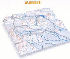 Places with similar names to Al Huwayb, Yemen ::
// Al Ḩuwīb (OM)
Disclaimer :: Information on this page comes without warranty of any kind |
||
|
Where is Al Huwayb? Elevation and coordinates ::
Latitude (lat): 13°12'0"N Longitude (lon): 44°9'0"E
Elevation (approx.): 1855m (map arrows pan, magnifying glasses zoom) |
||
|
Visiting Al Huwayb? Hotel/Accommodation ::
Book a hotel in Al Huwayb Travel Guide ::
Buy a travel guide for Yemen rental cars ::
car rental offers GPS waypoint ::
download a GPX waypoint (PoI) of Al Huwayb for your GPS receiver
|
||