|
search place name
|
||
Al Jāḩ (‘Adan, Yemen)Al Jāḩ is a town in the ‘Adan region of Yemen. An overview map of the region around Al Jāḩ is displayed below.
regional and 3d topo map of Al Jāḩ, Yemen ::

Nearby towns ::
Sūq ath Thuluth (2.6km north east) //
Al ‘Aqāʼir (3.7km south) //
Ad Dār (3.6km west) //
Qaryatayn (4.1km north east) //
Dār al Jayr (5.2km north east) //
Maavesh (5.2km north east) //
‘Adan al Ashlūḩ (5.4km south west) //
Dār al Jurd (5.4km west) //
Dusurat (5.7km west) //
Al Usni (5.8km north) //
Al Jidis (5.8km south) //
Al Mashā‘ibah (6.6km north west) //
Jumūmī (6.6km north west) //
Sizouat (6.6km north east) //
Seyani (7.2km west) //
Adin (7.4km west) //
Bisherak (7.4km west) //
An Nejade (7.4km west) //
Ad Dahanah (7.4km west) //
Dār al Yūsufī (7.6km north) //
Marīt (8.1km south west) //
Kemade (8.2km north west) //
Al Khāribah (8.2km north west) //
Al Bicht (8.1km north west) //
Al Hadre (8.1km north east) //
Najd al Jumā‘ī (8.1km north east) //
Manzil Duraybah (9.1km north west) //
Dār al Jabal (10.3km south west) //
Al Makhādir (10.3km north west) //
[all distances 'as the bird flies' and approximate] 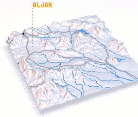 Places with similar names to Al Jāḩ, Yemen ::
Disclaimer :: Information on this page comes without warranty of any kind |
||
|
Where is Al Jāḩ? Elevation and coordinates ::
Latitude (lat): 13°53'0"N Longitude (lon): 44°15'0"E
Elevation (approx.): 1803m (map arrows pan, magnifying glasses zoom) |
||
|
Visiting Al Jāḩ? Hotel/Accommodation ::
Book a hotel in Al Jāḩ Travel Guide ::
Buy a travel guide for Yemen rental cars ::
car rental offers GPS waypoint ::
download a GPX waypoint (PoI) of Al Jāḩ for your GPS receiver
|
||