|
search place name
|
||
Al Jaḩī (‘Adan, Yemen)Al Jaḩī is a town in the ‘Adan region of Yemen. An overview map of the region around Al Jaḩī is displayed below.
regional and 3d topo map of Al Jaḩī, Yemen ::
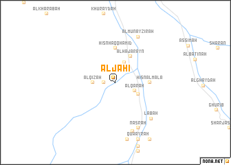
Nearby towns ::
Al Jidfirah (1.9km north) //
Nḩaulah (1.8km west) //
Khuraykhir (2.6km north east) //
Al Qārah (3.4km south east) //
Al Huwaylah (3.5km north east) //
Al Qizah (3.6km west) //
‘Az̧mah (4.0km south east) //
Al Hajarayn (4.8km north east) //
Ḩişn Ḩaqq Ḩāmid (5.6km north) //
Ḩişn al Ma‘lá (5.4km east) //
Labaḩ (8.1km south east) //
Nasrah (8.2km south east) //
Al Munayz̧irah (8.2km north east) //
Numayr (8.4km south) //
[all distances 'as the bird flies' and approximate] 
Disclaimer :: Information on this page comes without warranty of any kind |
||
|
Where is Al Jaḩī? Elevation and coordinates ::
Latitude (lat): 15°27'0"N Longitude (lon): 48°19'0"E
Elevation (approx.): 1047m (map arrows pan, magnifying glasses zoom) |
||
|
Visiting Al Jaḩī? Hotel/Accommodation ::
Book a hotel in Al Jaḩī Travel Guide ::
Buy a travel guide for Yemen rental cars ::
car rental offers GPS waypoint ::
download a GPX waypoint (PoI) of Al Jaḩī for your GPS receiver
|
||