|
search place name
|
||
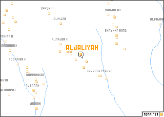
Al Ja‘līyah (Yemen)Al Ja‘līyah is a town in Yemen. An overview map of the region around Al Ja‘līyah is displayed below.
regional and 3d topo map of Al Ja‘līyah, Yemen ::
Nearby towns ::
Ḩays (1.3km south east) //
Biʼr Thābit (1.4km west) //
Al Jaruba (2.1km south) //
‘Ubarah (2.6km north west) //
Dhī Wādinah (3.0km north west) //
Al Jabw (3.6km north west) //
Al ‘Affāj (4.4km north west) //
Dār Mujārah (5.2km west) //
Aş Şurayḩ (5.4km south east) //
Dār as Sayyālah (5.6km south east) //
Al Majbah (5.9km north west) //
Nawbat as Sayyālah (7.0km south east) //
Dār Muḩarram (8.4km north east) //
Al Khuḑayrah (9.1km north east) //
Al Mijza‘ (9.3km north west) //
Salīm Bin Thābit (9.3km north east) //
Shaykh Aḩmad (9.3km north east) //
Al Bayāḑah (10.4km north east) //
Wālī Jaylān (10.4km south west) //
Ash Shudayf (10.5km north east) //
[all distances 'as the bird flies' and approximate]  Places with similar names to Al Ja‘līyah, Yemen ::
// Al Jahlīyah (OM)
// Al Ja‘alīyah (YE)
Disclaimer :: Information on this page comes without warranty of any kind |
||
|
Where is Al Ja‘līyah? Elevation and coordinates ::
Latitude (lat): 12°55'8"N Longitude (lon): 44°8'46"E
Elevation (approx.): 282m (map arrows pan, magnifying glasses zoom) |
||
|
Visiting Al Ja‘līyah? Hotel/Accommodation ::
Book a hotel in Al Ja‘līyah Travel Guide ::
Buy a travel guide for Yemen rental cars ::
car rental offers GPS waypoint ::
download a GPX waypoint (PoI) of Al Ja‘līyah for your GPS receiver
|
||