|
search place name
|
||
Al Jarrāḩī (Al Ḩudaydah, Yemen)Al Jarrāḩī is a town in the Al Ḩudaydah region of Yemen. An overview map of the region around Al Jarrāḩī is displayed below.
regional and 3d topo map of Al Jarrāḩī, Yemen ::
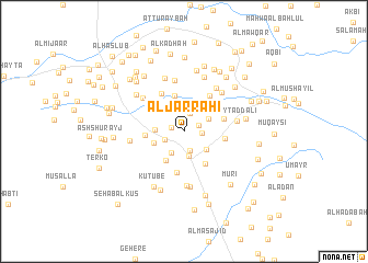
Nearby towns ::
Al Masāḩīb (1.3km west) //
Al Jirb al Asfal (1.6km north east) //
Qaryat al ‘Abīd (1.8km east) //
Al Ma‘āmirah (1.9km north) //
Hadīmat Ma‘āşilah (2.0km south) //
Bilād al Musāwāh (2.1km south west) //
Bayt Quraybah (2.5km south west) //
Banī Shirayhid (2.6km south) //
Al ‘Arīsh (2.7km north east) //
Qaryat as Sādah (2.9km west) //
Şayābah (2.9km south east) //
Janb al ‘Ayr (3.2km west) //
Umm Qubayr (3.5km south west) //
Maḩwá as Sayyid (3.8km north) //
At Turbah (3.9km west) //
Bayt Shirayhid (4.0km south east) //
Māti‘ (4.1km north west) //
Shi‘b ad Dālī (4.1km east) //
Shi‘b al ‘Ukdah (4.3km south) //
Ar Radādīyah (4.2km east) //
Al Mazra‘ (4.4km north west) //
Maḩall ash Shaykh (4.4km north east) //
Al Maḩşīm (4.5km north east) //
Az Zarībah (5.2km north) //
Maḩwá an Nāz̧ir (5.3km north west) //
Maḩall aţ Tawīl (5.4km north east) //
Bayt al Ḩawālī (5.4km north east) //
Al Ghashwah (5.6km south) //
Bayt ad Dālī (5.4km east) //
[all distances 'as the bird flies' and approximate] 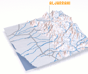 Places with similar names to Al Jarrāḩī, Yemen ::
// Al Jirāḩī (IQ)
Disclaimer :: Information on this page comes without warranty of any kind |
||
|
Where is Al Jarrāḩī? Elevation and coordinates ::
Latitude (lat): 14°8'2"N Longitude (lon): 43°23'40"E
Elevation (approx.): 170m (map arrows pan, magnifying glasses zoom) |
||
|
Visiting Al Jarrāḩī? Hotel/Accommodation ::
Book a hotel in Al Jarrāḩī Travel Guide ::
Buy a travel guide for Yemen rental cars ::
car rental offers GPS waypoint ::
download a GPX waypoint (PoI) of Al Jarrāḩī for your GPS receiver
|
||