|
search place name
|
||
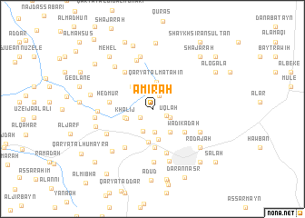
‘Amirah (Ta‘izz, Yemen)‘Amirah is a town in the Ta‘izz region of Yemen. An overview map of the region around ‘Amirah is displayed below.
regional and 3d topo map of ‘Amirah, Yemen ::
Nearby towns ::
Nashīţ (1.8km north east) //
Al ‘Āmirah (1.8km south west) //
Maqāşīş (1.8km south east) //
‘Uqlah (2.3km south east) //
Kharābah (2.9km south) //
Ad Dumaynah (3.0km south west) //
Barīhī (3.1km north west) //
Qaryat al Maţāḩin (3.3km north) //
Khalīj (3.3km west) //
Bayt al Hallidge (3.5km west) //
Ash Shajarah (3.6km south east) //
Shi‘b Ayūb (3.7km north west) //
Madīnat an Nūr (3.8km south) //
Biʼr Bāshah (4.1km south) //
Tahun (4.7km south) //
Wādī Kadah (4.8km south east) //
Shu‘bat Kuraymah (4.8km south east) //
Al Kharīf (4.8km south east) //
Hedmur (5.2km west) //
Ar Radai (5.6km north west) //
Al Hasab (5.7km south) //
Al Ḩumayrah (5.8km south west) //
Al Juhaymah (6.2km north) //
Ḩumarah (6.3km south west) //
Kalabah (6.4km south east) //
Al Ḩabīl (6.6km south) //
Sableiha (6.6km north) //
Şīnah (6.7km south) //
Al Afzār (6.6km west) //
[all distances 'as the bird flies' and approximate]  Places with similar names to ‘Amirah, Yemen ::
Disclaimer :: Information on this page comes without warranty of any kind |
||
|
Where is ‘Amirah? Elevation and coordinates ::
Latitude (lat): 13°37'33"N Longitude (lon): 43°58'50"E
Elevation (approx.): 1104m (map arrows pan, magnifying glasses zoom) |
||
|
Visiting ‘Amirah? Hotel/Accommodation ::
Book a hotel in ‘Amirah Travel Guide ::
Buy a travel guide for Yemen rental cars ::
car rental offers GPS waypoint ::
download a GPX waypoint (PoI) of ‘Amirah for your GPS receiver
|
||