|
search place name
|
||
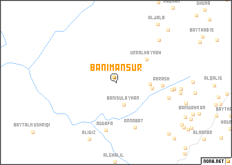
Banī Manşūr (Yemen)Banī Manşūr is a town in Yemen. An overview map of the region around Banī Manşūr is displayed below.
regional and 3d topo map of Banī Manşūr, Yemen ::
Banī Manşūr airports ::
The nearest airport is GIZ - Gizan King Abdullah Bin Abdulaziz, located 226.6 km north west of Banī Manşūr.
Nearby towns ::
Banī Sulaymān (3.9km south) //
Al ‘Urr (5.3km east) //
Al Hijrah (5.7km east) //
‘Urr al Ḩaymah (6.1km north east) //
Amrash (7.3km east) //
An Nābāt (7.8km south) //
Ad Dafāʼ (7.9km south) //
Al Ya‘ar (8.6km east) //
Bahkah (9.6km north east) //
Bayt az Zubdānī (11.6km south east) //
Al Qufl (11.8km north east) //
[all distances 'as the bird flies' and approximate] 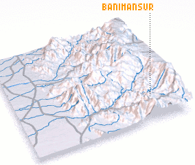 Places with similar names to Banī Manşūr, Yemen ::
Disclaimer :: Information on this page comes without warranty of any kind |
||
|
Where is Banī Manşūr? Elevation and coordinates ::
Latitude (lat): 15°14'58"N Longitude (lon): 43°50'18"E
Elevation (approx.): 1524m (map arrows pan, magnifying glasses zoom) |
||
|
Visiting Banī Manşūr? Hotel/Accommodation ::
Book a hotel in Banī Manşūr Travel Guide ::
Buy a travel guide for Yemen rental cars ::
car rental offers GPS waypoint ::
download a GPX waypoint (PoI) of Banī Manşūr for your GPS receiver
|
||