|
search place name
|
||
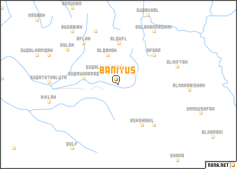
Banī Yūs (Yemen)Banī Yūs is a town in Yemen. An overview map of the region around Banī Yūs is displayed below.
regional and 3d topo map of Banī Yūs, Yemen ::
Banī Yūs airports ::
The nearest airport is GIZ - Gizan King Abdullah Bin Abdulaziz, located 131.5 km north west of Banī Yūs.
Other airports nearby include EAM - Nejran (208.1 km north east), Nearby towns ::
Sūq al Muḩarraq (2.9km north west) //
‘Alqamah (4.9km north) //
Sūq Muḩarraq (5.3km west) //
Al Qufl (6.5km north) //
‘Afşar (7.2km north east) //
Ash Shāhil (7.5km south east) //
Aflaḩ (8.3km north west) //
Al Wu‘līyah (8.5km south east) //
Kuḩlān ash Sharaf (9.0km north) //
Aslam (9.5km north west) //
Aslam an Nāshirī (10.0km north east) //
Aḑ Ḑabīah (10.9km north west) //
[all distances 'as the bird flies' and approximate] 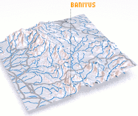 Places with similar names to Banī Yūs, Yemen ::
// Ban Yae So (TH)
// Ban Yi Sae (TH)
// Banāyūs (EG)
// Baniyaz (RU)
// Bāniyās (SY)
// Bāniyās (SY)
// Benayes (FR)
// Boneh-ye ‘Īsá (IR)
// Banʼyas (KZ)
Disclaimer :: Information on this page comes without warranty of any kind |
||
|
Where is Banī Yūs? Elevation and coordinates ::
Latitude (lat): 16°0'30"N Longitude (lon): 43°23'56"E
Elevation (approx.): 573m (map arrows pan, magnifying glasses zoom) |
||
|
Visiting Banī Yūs? Hotel/Accommodation ::
Book a hotel in Banī Yūs Travel Guide ::
Buy a travel guide for Yemen rental cars ::
car rental offers GPS waypoint ::
download a GPX waypoint (PoI) of Banī Yūs for your GPS receiver
|
||