|
search place name
|
||
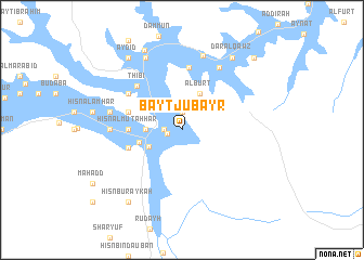
Bayt Jubayr (‘Adan, Yemen)Bayt Jubayr is a town in the ‘Adan region of Yemen. An overview map of the region around Bayt Jubayr is displayed below.
regional and 3d topo map of Bayt Jubayr, Yemen ::
Bayt Jubayr airports ::
The nearest airport is SHW - Sharurah, located 261.8 km north west of Bayt Jubayr.
Nearby towns ::
As Suwayrī (1.5km west) //
Ar Rayḑah (1.8km west) //
Al Mishţah (1.9km north) //
Ar Rawghah (1.9km north) //
Bayt Ḩufayy (3.6km west) //
Al Masīlah (3.7km south west) //
Al Burt (4.1km north east) //
Ghuraf (4.4km west) //
Dār Qisū (5.3km west) //
Ḩişn al Muţahhar (5.3km west) //
Ghuraf (5.7km west) //
Baranīyah (5.7km west) //
Khubāyah (6.5km north) //
Thibī (6.4km north west) //
Ar Ramlah (6.5km north west) //
Al Bayḑāʼ (7.1km west) //
Ḩişn Mubārak Bin ‘Umar (7.1km west) //
Al Kawdah (7.4km north east) //
Ḩişn al ‘Izz (7.4km west) //
Al Juḩayl (8.0km north) //
Al Ḩāwī (8.2km north west) //
Al Ghuwayḑah (8.2km north west) //
Tarīm (9.0km north west) //
Dār al Qawz (9.0km north east) //
Ḩişn Buraykah (9.1km south west) //
‘Aydīd (9.1km north west) //
Dār al Fahd (10.3km north east) //
Bā ‘Aţīr (10.3km north east) //
[all distances 'as the bird flies' and approximate] 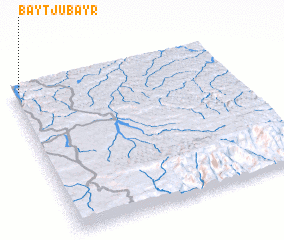 Places with similar names to Bayt Jubayr, Yemen ::
// Bayt Jabrū (SY)
// Bayt Jubārī (YE)
Disclaimer :: Information on this page comes without warranty of any kind |
||
|
Where is Bayt Jubayr? Elevation and coordinates ::
Latitude (lat): 15°59'0"N Longitude (lon): 49°2'0"E
Elevation (approx.): 620m (map arrows pan, magnifying glasses zoom) |
||
|
Visiting Bayt Jubayr? Hotel/Accommodation ::
Book a hotel in Bayt Jubayr Travel Guide ::
Buy a travel guide for Yemen rental cars ::
car rental offers GPS waypoint ::
download a GPX waypoint (PoI) of Bayt Jubayr for your GPS receiver
|
||