|
search place name
|
||
Behalī (‘Adan, Yemen)Behalī is a town in the ‘Adan region of Yemen. An overview map of the region around Behalī is displayed below.
regional and 3d topo map of Behalī, Yemen ::

Nearby towns ::
Bereke Dhale (1.8km east) //
Hukumet (1.8km west) //
Kechan (2.6km south east) //
Kashat Saddah (2.6km north east) //
Ad Dakhlah (2.6km south west) //
Nawbat Shara (3.7km south) //
Dakme (4.0km north east) //
Razmah (5.2km south east) //
Ḩabīl Ghurab (5.4km east) //
Sulaymānīyah (5.6km north) //
Derebe (5.8km north) //
Al Khiyārīyah (5.8km north) //
Al Makdar (5.8km south) //
Kashāt Ghanīm (6.5km north west) //
Thawkab (6.5km south east) //
Z̧ūrān (7.1km south west) //
Akamat Barkād (7.2km west) //
Qulay‘ al ‘Ulyā (7.2km east) //
Battār (7.4km east) //
Kavshal (7.4km west) //
Kasha (7.4km west) //
Jirhān (7.6km north) //
Atad (7.6km south) //
Al Ḩusayn (7.7km north east) //
Manşūrah (7.8km south east) //
Şulayyah (8.2km north west) //
Al Qaryah (8.2km south east) //
As Safaf (8.2km south east) //
‘Uqayb (9.0km south east) //
[all distances 'as the bird flies' and approximate] 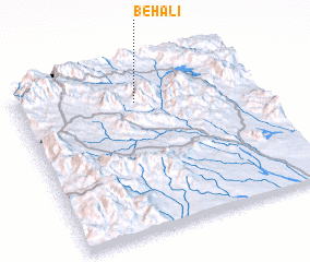 Places with similar names to Behalī, Yemen ::
Disclaimer :: Information on this page comes without warranty of any kind |
||
|
Where is Behalī? Elevation and coordinates ::
Latitude (lat): 13°48'0"N Longitude (lon): 44°30'0"E
Elevation (approx.): 1269m (map arrows pan, magnifying glasses zoom) |
||
|
Visiting Behalī? Hotel/Accommodation ::
Book a hotel in Behalī Travel Guide ::
Buy a travel guide for Yemen rental cars ::
car rental offers GPS waypoint ::
download a GPX waypoint (PoI) of Behalī for your GPS receiver
|
||