|
search place name
|
||
Dār Aghui (Al Ḩudaydah, Yemen)Dār Aghui is a town in the Al Ḩudaydah region of Yemen. An overview map of the region around Dār Aghui is displayed below.
regional and 3d topo map of Dār Aghui, Yemen ::

Dār Aghui airports ::
The nearest airport is GIZ - Gizan King Abdullah Bin Abdulaziz, located 219.5 km north of Dār Aghui.
Nearby towns ::
Dayr aţ Ţawīl (0.5km north east) //
Al Khaţwah (0.9km west) //
Dayr Juraynah (1.1km west) //
Dayr ‘Ubayd (1.3km south west) //
Al Baḩīḩ (1.8km east) //
Dayr Ashral (1.8km west) //
Dumar (1.8km west) //
Dayr as Sādah (2.1km north west) //
Al Mikshāʼ (2.7km north west) //
Ḩizzal Mushāharah (3.1km south) //
Al Hayj (3.2km north west) //
Akhal (3.7km south) //
Gharīf (3.6km west) //
Al Qurayn (3.7km south east) //
Al Ḩişn (3.8km south) //
Al Kurd (3.9km east) //
Iskandar (4.0km north east) //
Marra (4.0km north east) //
Dayr as Sādah (4.1km north west) //
Dayr Juraynah (4.0km west) //
Ḩizz aş Şarmayn (4.5km south) //
‘Izzān (4.6km north) //
Khurshubah (4.7km north) //
Al Ḩayd (4.6km east) //
Ḩizz al Ashrāf (5.0km south) //
Faydar (5.3km south) //
Al Mu‘tariḑ (5.4km north) //
Ad Diman (5.4km south west) //
Jarīr (5.8km south) //
[all distances 'as the bird flies' and approximate] 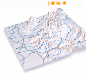 Places with similar names to Dār Aghui, Yemen ::
Disclaimer :: Information on this page comes without warranty of any kind |
||
|
Where is Dār Aghui? Elevation and coordinates ::
Latitude (lat): 15°4'0"N Longitude (lon): 43°22'0"E
Elevation (approx.): 356m (map arrows pan, magnifying glasses zoom) |
||
|
Visiting Dār Aghui? Hotel/Accommodation ::
Book a hotel in Dār Aghui Travel Guide ::
Buy a travel guide for Yemen rental cars ::
car rental offers GPS waypoint ::
download a GPX waypoint (PoI) of Dār Aghui for your GPS receiver
|
||