|
search place name
|
||
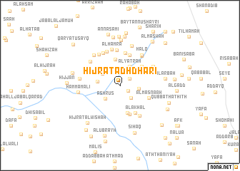
Ḩijrat adh Dharī (Yemen)Ḩijrat adh Dharī is a town in Yemen. An overview map of the region around Ḩijrat adh Dharī is displayed below.
regional and 3d topo map of Ḩijrat adh Dharī, Yemen ::
Nearby towns ::
Shahbān (1.5km south east) //
Al Aribe (1.8km north east) //
Banī Ḑabyān (2.4km north east) //
Al Yitarah (2.6km south east) //
Al Ḩibs (2.7km north) //
Bayt Abū Ḩasan (2.9km east) //
‘Ashrūs (3.1km south west) //
Al Yatrah (3.3km north east) //
Al Jabjab (3.2km north west) //
Al Qāhir (3.4km west) //
Ghāwir (4.2km north) //
Gairiat (4.4km north east) //
Al Miḩdājah (4.5km south) //
Al ‘Adan (4.7km south) //
Al Akḩal (4.8km south east) //
Al Masna‘ah (4.8km south east) //
Bayt Haidad (5.0km north) //
Rifd (5.1km north) //
Bayt al Khaḑr (5.5km north) //
Lakamat ash Shāwish (5.4km north east) //
Ghāribayn (5.6km north) //
Al Kharābah (5.6km south east) //
Al Marqab (5.7km north west) //
Al Ḩamrāʼ (5.8km north) //
Bayt az Zāb (5.7km north east) //
Ḩalq (5.8km north east) //
Al Ku‘b (5.8km north west) //
Al Ḩāfah (5.8km north west) //
Qaryat al Qubbah (5.8km north east) //
[all distances 'as the bird flies' and approximate]  Places with similar names to Ḩijrat adh Dharī, Yemen :: Disclaimer :: Information on this page comes without warranty of any kind |
||
|
Where is Ḩijrat adh Dharī? Elevation and coordinates ::
Latitude (lat): 14°40'26"N Longitude (lon): 44°12'11"E
Elevation (approx.): 1980m (map arrows pan, magnifying glasses zoom) |
||
|
Visiting Ḩijrat adh Dharī? Hotel/Accommodation ::
Book a hotel in Ḩijrat adh Dharī Travel Guide ::
Buy a travel guide for Yemen rental cars ::
car rental offers GPS waypoint ::
download a GPX waypoint (PoI) of Ḩijrat adh Dharī for your GPS receiver
|
||