|
search place name
|
||
Ḩillat al ‘Amārah (Al Ḩudaydah, Yemen)Ḩillat al ‘Amārah is a town in the Al Ḩudaydah region of Yemen. An overview map of the region around Ḩillat al ‘Amārah is displayed below.
regional and 3d topo map of Ḩillat al ‘Amārah, Yemen ::

Nearby towns ::
Ad Damāh (2.2km north) //
Kidf Khuḑayr (2.1km east) //
Maḩallat al ‘Uways (2.4km south) //
Ḩāsī ash Shākh (2.4km south) //
Ḩanab (3.1km north east) //
Buyūt an Nahārīyīn (3.2km north east) //
Bayt al Faqīh (3.2km west) //
Al Quz‘ah (3.4km east) //
Qaryat aţ Ţabbālīyah (3.6km north) //
Kidf as Salaʼ (3.6km east) //
Aţ Ţabbālīyah (3.7km north west) //
Bayt al Faqīr (4.0km north west) //
Somani (4.0km west) //
Sanīf al ‘Amārah (4.2km east) //
At Turbah (5.3km north west) //
Al Qāʼim (5.3km north east) //
Jubbah (5.4km south east) //
Al Minjārah (5.4km north east) //
Kidf al Majāhişah (5.5km north west) //
Al Majāhişah (5.7km north) //
Al Maşabah (5.7km north) //
Al Ḩamrāʼ (5.8km east) //
Hadarah (5.8km west) //
Jenne (5.8km west) //
Al Kudayrah (6.2km north) //
Qaryat as Sa‘ādīyah (6.0km west) //
Al Kadīd (6.2km north east) //
Buyūt al ‘Ijālīyah (6.2km north east) //
Bayt al Farīd (6.3km north east) //
[all distances 'as the bird flies' and approximate] 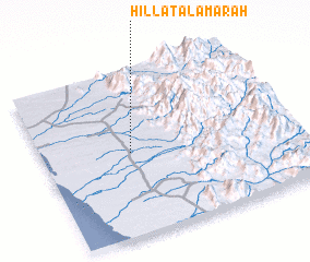 Places with similar names to Ḩillat al ‘Amārah, Yemen :: Disclaimer :: Information on this page comes without warranty of any kind |
||
|
Where is Ḩillat al ‘Amārah? Elevation and coordinates ::
Latitude (lat): 14°30'18"N Longitude (lon): 43°21'8"E
Elevation (approx.): 154m (map arrows pan, magnifying glasses zoom) |
||
|
Visiting Ḩillat al ‘Amārah? Hotel/Accommodation ::
Book a hotel in Ḩillat al ‘Amārah Travel Guide ::
Buy a travel guide for Yemen rental cars ::
car rental offers GPS waypoint ::
download a GPX waypoint (PoI) of Ḩillat al ‘Amārah for your GPS receiver
|
||