|
search place name
|
||
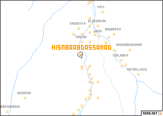
Ḩişn Bā ‘Abd aş Şamad (‘Adan, Yemen)Ḩişn Bā ‘Abd aş Şamad is a town in the ‘Adan region of Yemen. An overview map of the region around Ḩişn Bā ‘Abd aş Şamad is displayed below.
regional and 3d topo map of Ḩişn Bā ‘Abd aş Şamad, Yemen ::
Nearby towns ::
Buḑah (1.5km north west) //
Al Jubayl (1.9km south) //
Maţruh (2.3km south) //
Az̧ Z̧āhir (2.6km south east) //
Quwayrat al Khazab (2.7km south east) //
Tamlah (3.7km north) //
Khusofar (4.1km south east) //
Al Barshī (4.1km south east) //
Jibāb (4.1km south east) //
Al Qufl (4.1km north east) //
Ḩadūn (5.1km south east) //
Qarn Mājid (5.6km north) //
Ḩuwaybah (5.8km south) //
Bilād al Māʼ (5.8km north) //
Ruḩāb (6.1km south east) //
Şubayrah (6.2km north east) //
Tāfilah (6.3km north) //
Jarīf (6.4km north east) //
Ḩalbūn (6.6km south east) //
Al Jadīdah (6.5km north east) //
Subaykh (6.5km north east) //
Khudaysh (6.9km north) //
Al Mishqa‘ah (7.4km east) //
Al Quwayrah (7.6km south) //
Kawkah (7.6km north) //
Ad Dūfah (7.7km north east) //
Al ‘Uraysimah (8.2km north east) //
Al ‘Arsamah (8.2km north east) //
Al Qurayn (8.5km south) //
[all distances 'as the bird flies' and approximate] 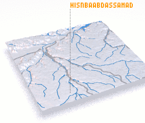 Places with similar names to Ḩişn Bā ‘Abd aş Şamad, Yemen :: Disclaimer :: Information on this page comes without warranty of any kind |
||
|
Where is Ḩişn Bā ‘Abd aş Şamad? Elevation and coordinates ::
Latitude (lat): 15°12'0"N Longitude (lon): 48°19'0"E
Elevation (approx.): 1108m (map arrows pan, magnifying glasses zoom) |
||
|
Visiting Ḩişn Bā ‘Abd aş Şamad? Hotel/Accommodation ::
Book a hotel in Ḩişn Bā ‘Abd aş Şamad Travel Guide ::
Buy a travel guide for Yemen rental cars ::
car rental offers GPS waypoint ::
download a GPX waypoint (PoI) of Ḩişn Bā ‘Abd aş Şamad for your GPS receiver
|
||