|
search place name
|
||
Maḩall al Madhāb (Muḩāfaz̧at al Maḩwīt, Yemen)Maḩall al Madhāb is a town in the Muḩāfaz̧at al Maḩwīt region of Yemen. An overview map of the region around Maḩall al Madhāb is displayed below.
regional and 3d topo map of Maḩall al Madhāb, Yemen ::

Maḩall al Madhāb airports ::
The nearest airport is GIZ - Gizan King Abdullah Bin Abdulaziz, located 205.8 km north west of Maḩall al Madhāb.
Nearby towns ::
Maḩall al ‘Uqayr (1.9km north) //
Al Ḩūwās (1.9km south) //
Al Ḩamrāʼ (1.9km south) //
Ar Rufī‘ (2.8km south) //
Hasira (5.7km west) //
Ju‘āfirah (5.8km north) //
Al Ḩusaynīyah (6.5km west) //
Zubayyilī (7.2km west) //
Maḩall al Bukayrah (7.5km south) //
Sūq al Khamīs (8.2km north east) //
Bāb an Nāqah (9.1km south) //
Shafahsin (9.1km north west) //
Şabārīyah (9.6km south west) //
Huwā‘ (11.4km north east) //
[all distances 'as the bird flies' and approximate] 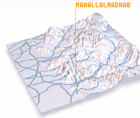 Places with similar names to Maḩall al Madhāb, Yemen :: Disclaimer :: Information on this page comes without warranty of any kind |
||
|
Where is Maḩall al Madhāb? Elevation and coordinates ::
Latitude (lat): 15°13'0"N Longitude (lon): 43°24'0"E
Elevation (approx.): 376m (map arrows pan, magnifying glasses zoom) |
||
|
Visiting Maḩall al Madhāb? Hotel/Accommodation ::
Book a hotel in Maḩall al Madhāb Travel Guide ::
Buy a travel guide for Yemen rental cars ::
car rental offers GPS waypoint ::
download a GPX waypoint (PoI) of Maḩall al Madhāb for your GPS receiver
|
||