|
search place name
|
||
Nawbat al ‘Ubaydah (‘Adan, Yemen)Nawbat al ‘Ubaydah is a town in the ‘Adan region of Yemen. An overview map of the region around Nawbat al ‘Ubaydah is displayed below.
regional and 3d topo map of Nawbat al ‘Ubaydah, Yemen ::

Nearby towns ::
Al Jarbāʼ (1.4km north) //
Ash Sharj (1.7km south west) //
Ad Darb aţ Ţawīl (2.0km south west) //
Şabir (2.3km north) //
Al Wahţ (3.2km west) //
Biʼr Nāşir (3.2km south east) //
Al Mismār (3.6km north) //
Qadamat Shu‘aybī (3.6km south west) //
Dār ‘Amr Maʼuda (3.7km north) //
Jalājil (4.5km north west) //
Al Ḩubayyil (4.7km north east) //
‘Ambarah (5.3km north west) //
Al Wa‘arah (5.3km north east) //
Harrān (5.9km north east) //
Al Fayūsh (6.1km east) //
Ḩaydarah (6.2km north west) //
Harrān (6.4km north west) //
Al Majḩifah (7.1km north) //
Ţahrūr (7.4km north) //
Nawbat ‘Iyād (7.6km north west) //
Al Ḩamrāʼ (8.5km north) //
Al Jawl (8.5km north west) //
Kudaymah (8.9km north) //
‘Ubar al Aslūm (9.0km north west) //
Laḩij (9.1km north west) //
Dār Manşūr (9.7km south east) //
Ash Shuz̧ayf (9.9km north west) //
Rubāţ (10.5km south east) //
[all distances 'as the bird flies' and approximate] 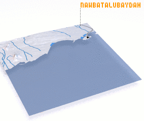 Places with similar names to Nawbat al ‘Ubaydah, Yemen :: Disclaimer :: Information on this page comes without warranty of any kind |
||
|
Where is Nawbat al ‘Ubaydah? Elevation and coordinates ::
Latitude (lat): 12°59'0"N Longitude (lon): 44°55'9"E
Elevation (approx.): 66m (map arrows pan, magnifying glasses zoom) |
||
|
Visiting Nawbat al ‘Ubaydah? Hotel/Accommodation ::
Book a hotel in Nawbat al ‘Ubaydah Travel Guide ::
Buy a travel guide for Yemen rental cars ::
car rental offers GPS waypoint ::
download a GPX waypoint (PoI) of Nawbat al ‘Ubaydah for your GPS receiver
|
||