|
search place name
|
||
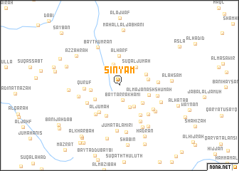
Sinyām (‘Adan, Yemen)Sinyām is a town in the ‘Adan region of Yemen. An overview map of the region around Sinyām is displayed below.
regional and 3d topo map of Sinyām, Yemen ::
Nearby towns ::
Bayt ar Rakhamī (2.4km south) //
Wabrah (3.5km north) //
Walāʼ (3.7km south east) //
Sūq al Jum‘ah (3.8km north east) //
Kurabah (3.9km south east) //
Banī Nashwān (4.3km south west) //
Ḑulaym (4.4km north east) //
Maḩlīt (4.5km south east) //
Ta‘izz (4.4km east) //
Qarn ‘Arrah (4.4km west) //
Al Ḩarf (4.7km north) //
Al Majan ash Shumah (4.7km east) //
Ash Shumah (5.2km south west) //
Al Jum‘ah (5.2km south west) //
Quruf (5.3km west) //
Al Ḩarf (5.7km south east) //
Ḩamal (5.6km south west) //
Maḩall al Qal‘ah (5.8km south west) //
Bayt al Umaysī (5.9km east) //
Şā‘ah (6.0km east) //
Banī Salāmah (6.3km south east) //
Mawthab (6.5km south east) //
Al Ghudham (6.4km south east) //
Al Ma‘ábirah (6.4km west) //
Bayt Ḩumrān (6.9km north west) //
Al Mashā‘ibah (6.8km south east) //
Al Kharābah (6.8km east) //
Jum‘at al ‘Āmirī (7.1km south) //
Sharaf al Izār (7.4km south) //
[all distances 'as the bird flies' and approximate]  Places with similar names to Sinyām, Yemen ::
Disclaimer :: Information on this page comes without warranty of any kind |
||
|
Where is Sinyām? Elevation and coordinates ::
Latitude (lat): 14°46'28"N Longitude (lon): 43°59'35"E
Elevation (approx.): 1939m (map arrows pan, magnifying glasses zoom) |
||
|
Visiting Sinyām? Hotel/Accommodation ::
Book a hotel in Sinyām Travel Guide ::
Buy a travel guide for Yemen rental cars ::
car rental offers GPS waypoint ::
download a GPX waypoint (PoI) of Sinyām for your GPS receiver
|
||