|
search place name
|
||
Waylah (‘Adan, Yemen)Waylah is a town in the ‘Adan region of Yemen. An overview map of the region around Waylah is displayed below.
regional and 3d topo map of Waylah, Yemen ::
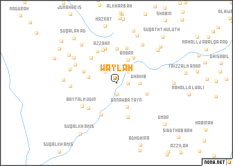
Nearby towns ::
Al Jumayḩah (1.8km east) //
Sajd (1.9km south) //
Ta‘izz (2.6km north west) //
Skerm (2.6km north east) //
Dhāhib (3.6km east) //
‘Anbān (4.1km north east) //
An Nawbatayn (4.1km south east) //
Ar Ribāţ (4.5km west) //
Madīnat ash Shirq (4.9km north east) //
Sūq as Sabt (5.0km east) //
‘Utmah (5.6km north) //
Al Maḩrūrah (5.4km west) //
Sūq al Ithnayn (5.6km south west) //
Az̧ Z̧ahr (5.7km north) //
Maḑba‘ah (5.7km north west) //
Bayt al Maq‘ād (5.8km north) //
Ar Rubū‘ (5.8km south) //
Lakamat al ‘Azab (5.8km north) //
Aş Şirm (5.9km north west) //
Ash Shuwab (6.0km south west) //
Bayt al Mudīr (6.5km south west) //
Naylah (7.1km north west) //
Al Jallah (7.2km west) //
Al Ma‘zibah (7.4km north east) //
As Sawdāʼ (7.7km west) //
Bal Jābirī (7.8km north west) //
Qanna‘ (8.3km north) //
Ribāţ Bal Askarī (8.3km north west) //
Maḑarah (8.3km north east) //
[all distances 'as the bird flies' and approximate] 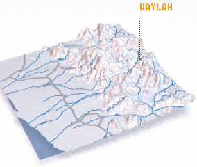 Places with similar names to Waylah, Yemen ::
Disclaimer :: Information on this page comes without warranty of any kind |
||
|
Where is Waylah? Elevation and coordinates ::
Latitude (lat): 14°36'0"N Longitude (lon): 43°56'0"E
Elevation (approx.): 1203m (map arrows pan, magnifying glasses zoom) |
||
|
Visiting Waylah? Hotel/Accommodation ::
Book a hotel in Waylah Travel Guide ::
Buy a travel guide for Yemen rental cars ::
car rental offers GPS waypoint ::
download a GPX waypoint (PoI) of Waylah for your GPS receiver
|
||