|
search place name
|
||
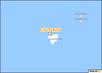
Chung-p'ing (T'ai-wan, Taiwan)Chung-p'ing is a town in the T'ai-wan region of Taiwan. An overview map of the region around Chung-p'ing is displayed below.
regional and 3d topo map of Chung-p'ing, Taiwan ::
Chung-p'ing airports ::
The nearest airport is WOT - Wang An, located 18.8 km north east of Chung-p'ing.
Other airports nearby include MZG - Makung Magong (44.6 km north east), TNN - Tainan (86.1 km east), CYI - Chiayi (103.5 km east), KHH - Kaohsiung Intl (119.1 km south east), Nearby towns ::
Wu-kou-k'ou (0.0km north) //
Hsi-hu-ts'un (0.0km north) //
Hai-feng-ts'un (0.0km north) //
Tung-hsi-ts'un (1.7km east) //
Nan-hai (1.9km south) //
Chung-ho-ts'un (2.5km south east) //
Nan-kang-ts'un (2.5km south east) //
[all distances 'as the bird flies' and approximate]  Places with similar names to Chung-p'ing, Taiwan ::
// Chong Pang (SG)
// Shangpung (IN)
// Ch'ŏngp'ung (KR)
// Shangping (CN)
// Shuangping (CN)
// Ch'ang-p'ing (TW)
// Ch'ang-p'ing (TW)
// Chang-p'ing (TW)
// Chung-p'ing (TW)
// Chung-p'ing (TW)
Disclaimer :: Information on this page comes without warranty of any kind |
||
|
Where is Chung-p'ing? Elevation and coordinates ::
Latitude (lat): 23°13'0"N Longitude (lon): 119°25'0"E
Elevation (approx.): 7m (map arrows pan, magnifying glasses zoom) |
||
|
Visiting Chung-p'ing? Hotel/Accommodation ::
Book a hotel in Chung-p'ing Travel Guide ::
Buy a travel guide for Taiwan rental cars ::
car rental offers GPS waypoint ::
download a GPX waypoint (PoI) of Chung-p'ing for your GPS receiver
|
||