|
search place name
|
||
Hsing-fu-liao (T'ai-wan, Taiwan)Hsing-fu-liao is a town in the T'ai-wan region of Taiwan. An overview map of the region around Hsing-fu-liao is displayed below.
regional and 3d topo map of Hsing-fu-liao, Taiwan ::

Hsing-fu-liao airports ::
The nearest airport is TSA - Taipei Sungshan, located 12.8 km south east of Hsing-fu-liao.
Other airports nearby include TPE - Taipei Chiang Kai Shek Intl (27.1 km west), HUN - Hualien (127.4 km south), OGN - Yonaguni Jima Yonaguni (169.8 km south east), MZW - Matsu Beigan (189.2 km north west), Nearby towns ::
Fen-chi-hu (0.0km north) //
San-k'ung-ch'üan (1.7km west) //
Shu-lin-k'ou (1.7km west) //
Yung-yüan (1.9km north) //
Shan-tzu-ting (1.9km north) //
Shu-hsing (1.9km north) //
Shih-t'ou-ts'o (1.9km south) //
Ting-pei-t'ou (1.9km south) //
Chung-ch'ing-yen (1.7km east) //
Pei-tzu-t'ou (1.9km south) //
Shui-yüan-li (2.5km north west) //
Nan-shih (2.5km north west) //
Wa-yao-k'eng (2.5km north west) //
Tsou-ts'o-lun (2.5km north west) //
Shan-tzu-pien (2.5km north west) //
Shu-mei (2.5km south west) //
Hsiao-p'ing-ting (2.5km south west) //
Wai-pei-shih (2.5km south west) //
Pai-liu-chia (2.5km north east) //
Feng-shu-hu (2.5km north east) //
Hsin-pei-t'ou (2.5km south east) //
Shih-pa-fen (2.5km south east) //
Ta-t'un (2.5km south east) //
Hu-t'ou-shan (3.4km west) //
Ch'üan-chou-ts'o (3.7km north) //
Ta-p'i-t'ou (3.7km north) //
T'ien-hsin-tzu (3.7km north) //
Chung-t'ien-liao (3.7km north) //
P'ing-pu (3.7km south) //
[all distances 'as the bird flies' and approximate] 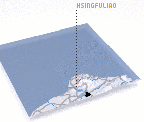 Places with similar names to Hsing-fu-liao, Taiwan ::
// Senecaville (US)
// Zincville (US)
// Singavele (CD)
// Sanga Vila (CG)
// Sankuveli (LK)
// Snake Valley (AU)
// Zinkval (BE)
// Zankoifla (CI)
Disclaimer :: Information on this page comes without warranty of any kind |
||
|
Where is Hsing-fu-liao? Elevation and coordinates ::
Latitude (lat): 25°10'0"N Longitude (lon): 121°29'0"E
Elevation (approx.): 344m (map arrows pan, magnifying glasses zoom) |
||
|
Visiting Hsing-fu-liao? Hotel/Accommodation ::
Book a hotel in Hsing-fu-liao Travel Guide ::
Buy a travel guide for Taiwan rental cars ::
car rental offers GPS waypoint ::
download a GPX waypoint (PoI) of Hsing-fu-liao for your GPS receiver
|
||