|
search place name
|
||
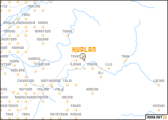
Hua-lan (T'ai-wan, Taiwan)Hua-lan is a town in the T'ai-wan region of Taiwan. An overview map of the region around Hua-lan is displayed below.
regional and 3d topo map of Hua-lan, Taiwan ::
Hua-lan airports ::
The nearest airport is PIF - Pingtung South, located 28.2 km west of Hua-lan.
Other airports nearby include TTT - Fengnin (39.6 km east), KHH - Kaohsiung Intl (43.1 km south west), TNN - Tainan (56.2 km west), GNI - Green Island Lyudao (77.7 km east), Nearby towns ::
Chia-mu (0.0km north) //
Hua-jung (1.9km south) //
Wu-t'ai (1.9km south) //
Te-wen (1.7km west) //
Hsiang-chu (1.7km west) //
Ch'ü-nu (2.5km south east) //
P'ai-wan (2.5km north west) //
I-la-she (2.5km south west) //
To-k'ou-she (3.9km south east) //
A-li (5.0km south east) //
Li-lu (5.5km east) //
Ma-erh (5.8km south) //
Ta-lai (6.5km south west) //
Ta-she (6.5km north west) //
Hao-ch'a (7.6km south) //
San-ti-ts'un (8.8km south west) //
San-ti-hsiang (8.8km south west) //
Fa-lü (9.0km south west) //
[all distances 'as the bird flies' and approximate]  Places with similar names to Hua-lan, Taiwan ::
Disclaimer :: Information on this page comes without warranty of any kind |
||
|
Where is Hua-lan? Elevation and coordinates ::
Latitude (lat): 22°46'0"N Longitude (lon): 120°43'0"E
Elevation (approx.): 514m (map arrows pan, magnifying glasses zoom) |
||
|
Visiting Hua-lan? Hotel/Accommodation ::
Book a hotel in Hua-lan Travel Guide ::
Buy a travel guide for Taiwan rental cars ::
car rental offers GPS waypoint ::
download a GPX waypoint (PoI) of Hua-lan for your GPS receiver
|
||