|
search place name
|
||
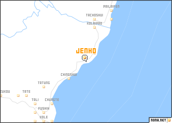
Jen-ho (T'ai-wan, Taiwan)Jen-ho is a town in the T'ai-wan region of Taiwan. An overview map of the region around Jen-ho is displayed below.
regional and 3d topo map of Jen-ho, Taiwan ::
Jen-ho airports ::
The nearest airport is HUN - Hualien, located 27.1 km south of Jen-ho.
Other airports nearby include TSA - Taipei Sungshan (92.3 km north), TPE - Taipei Chiang Kai Shek Intl (103.9 km north west), OGN - Yonaguni Jima Yonaguni (130.2 km east), CYI - Chiayi (160.6 km south west), Nearby towns ::
Ho-p'ing (2.5km north east) //
Ch'ing-shui (5.0km south west) //
Ho-p'ing (7.6km north) //
K'o-lai-pao (7.6km north) //
[all distances 'as the bird flies' and approximate] 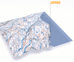 Places with similar names to Jen-ho, Taiwan ::
Disclaimer :: Information on this page comes without warranty of any kind |
||
|
Where is Jen-ho? Elevation and coordinates ::
Latitude (lat): 24°15'0"N Longitude (lon): 121°43'0"E
Elevation (approx.): 95m (map arrows pan, magnifying glasses zoom) |
||
|
Visiting Jen-ho? Hotel/Accommodation ::
Book a hotel in Jen-ho Travel Guide ::
Buy a travel guide for Taiwan rental cars ::
car rental offers GPS waypoint ::
download a GPX waypoint (PoI) of Jen-ho for your GPS receiver
|
||