|
search place name
|
||
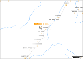
Mi-mo-teng (T'ai-wan, Taiwan)Mi-mo-teng is a town in the T'ai-wan region of Taiwan. An overview map of the region around Mi-mo-teng is displayed below.
regional and 3d topo map of Mi-mo-teng, Taiwan ::
Mi-mo-teng airports ::
The nearest airport is HUN - Hualien, located 53.0 km south east of Mi-mo-teng.
Other airports nearby include TPE - Taipei Chiang Kai Shek Intl (72.4 km north), TSA - Taipei Sungshan (73.4 km north), CYI - Chiayi (145.2 km south west), OGN - Yonaguni Jima Yonaguni (165.1 km east), Nearby towns ::
Ma-tang (1.9km south) //
P'i-nan (1.7km east) //
Ssu-yüan-ya-k'ou (3.7km south) //
T'u-leng (3.7km south) //
Mi-lo (3.4km east) //
Ssu-yüan (5.8km south) //
Ma-la-wu-yang (6.3km north east) //
Sheng-kuang (7.6km south) //
Ssu-chi (8.7km north east) //
[all distances 'as the bird flies' and approximate] 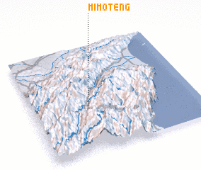 Places with similar names to Mi-mo-teng, Taiwan ::
Disclaimer :: Information on this page comes without warranty of any kind |
||
|
Where is Mi-mo-teng? Elevation and coordinates ::
Latitude (lat): 24°26'0"N Longitude (lon): 121°21'0"E
Elevation (approx.): 1897m (map arrows pan, magnifying glasses zoom) |
||
|
Visiting Mi-mo-teng? Hotel/Accommodation ::
Book a hotel in Mi-mo-teng Travel Guide ::
Buy a travel guide for Taiwan rental cars ::
car rental offers GPS waypoint ::
download a GPX waypoint (PoI) of Mi-mo-teng for your GPS receiver
|
||