|
search place name
|
||
Po-ai (T'ai-wan, Taiwan)Po-ai is a town in the T'ai-wan region of Taiwan. An overview map of the region around Po-ai is displayed below.
regional and 3d topo map of Po-ai, Taiwan ::

Po-ai airports ::
The nearest airport is HUN - Hualien, located 68.1 km east of Po-ai.
Other airports nearby include CYI - Chiayi (97.5 km south west), TPE - Taipei Chiang Kai Shek Intl (104.5 km north), TSA - Taipei Sungshan (116.3 km north east), MZG - Makung Magong (151.6 km south west), Nearby towns ::
Sung-ho (1.9km north) //
Chiu-liang-hsi (1.9km north) //
Li-leng (1.7km west) //
Li-yang (2.5km north east) //
Po-ai-ts'un (2.5km north east) //
Chung-leng (3.4km west) //
Chia-pao-t'ai (3.9km north east) //
Ha-lung-t'ai (4.1km north east) //
Ku-kuan (5.0km north east) //
Hsia-ku-kuan (5.0km north east) //
P'ing-shui-t'a (5.4km west) //
Pai-leng (5.4km west) //
Li-ming (6.8km east) //
Pai-lu (6.8km west) //
Hsin-shan (7.7km north east) //
Chung-k'eng-ts'un (10.0km north west) //
[all distances 'as the bird flies' and approximate] 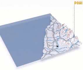 Places with similar names to Po-ai, Taiwan ::
Disclaimer :: Information on this page comes without warranty of any kind |
||
|
Where is Po-ai? Elevation and coordinates ::
Latitude (lat): 24°10'0"N Longitude (lon): 120°58'0"E
Elevation (approx.): 785m (map arrows pan, magnifying glasses zoom) |
||
|
Visiting Po-ai? Hotel/Accommodation ::
Book a hotel in Po-ai Travel Guide ::
Buy a travel guide for Taiwan rental cars ::
car rental offers GPS waypoint ::
download a GPX waypoint (PoI) of Po-ai for your GPS receiver
|
||