|
search place name
|
||
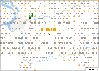
Wang-tan (T'ai-wan, Taiwan)Wang-tan is a town in the T'ai-wan region of Taiwan. An overview map of the region around Wang-tan is displayed below.
regional and 3d topo map of Wang-tan, Taiwan ::
nearby GPS traces from timatio ::
Wang-tan airports ::
The nearest airport is TSA - Taipei Sungshan, located 10.1 km north west of Wang-tan.
Other airports nearby include TPE - Taipei Chiang Kai Shek Intl (39.7 km west), HUN - Hualien (108.2 km south), OGN - Yonaguni Jima Yonaguni (149.8 km south east), CYI - Chiayi (210.9 km south west), Nearby towns ::
Sheng-kao-k'eng (0.0km north) //
Yüan-shan (1.7km east) //
Wang-chün-liao (1.9km south) //
Nan-pang-liao (1.9km south) //
Wu-yüeh (1.9km north) //
Shan-chu-k'u-t'ou (1.9km north) //
Hsiang-t'ien-hu (1.9km south) //
T'u-k'u (1.9km north) //
Peng-shan (1.9km north) //
Ta-p'ing (1.9km north) //
Ta-lun-chiao (1.7km west) //
Shen-k'eng (1.7km west) //
Kung-kuan-hou (1.7km west) //
Chien-chiao-k'eng (1.7km west) //
Wan-shun-liao (1.7km west) //
T'u-k'u-chien (2.5km north east) //
Chih-tzu-t'ou (2.5km south east) //
Fen-liao (2.5km north east) //
Shan-yang-tung (2.5km south east) //
Mu-ju (2.5km south east) //
Feng-tzu-lin (2.5km north east) //
Ta-lun-wei (2.5km south west) //
P'ao-tzu-lun (2.5km south west) //
A-Sang-k'eng (2.5km south west) //
A-jou-yang (2.5km south west) //
Ta-k'eng (2.5km north west) //
Ta-k'eng-wai-ku (2.5km north west) //
Shih-k'an-t'ou (3.7km south) //
Chiu-chuang (3.7km north) //
[all distances 'as the bird flies' and approximate] 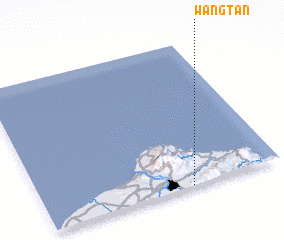 Places with similar names to Wang-tan, Taiwan ::
// Wanquetin (FR)
// Wang-t'ien (TW)
// Wahnkai Town (LR)
// Wān Ngūtnö (MM)
// Wangdian (CN)
// Wangdian (CN)
// Wangdian (CN)
// Wangdian (CN)
// Wangdian (CN)
// Wangdian (CN)
Disclaimer :: Information on this page comes without warranty of any kind |
||
|
Where is Wang-tan? Elevation and coordinates ::
Latitude (lat): 25°0'0"N Longitude (lon): 121°37'0"E
Elevation (approx.): 32m (map arrows pan, magnifying glasses zoom) |
||
|
Visiting Wang-tan? Hotel/Accommodation ::
Book a hotel in Wang-tan Travel Guide ::
Buy a travel guide for Taiwan rental cars ::
car rental offers GPS waypoint ::
download a GPX waypoint (PoI) of Wang-tan for your GPS receiver
|
||