|
search place name
|
||
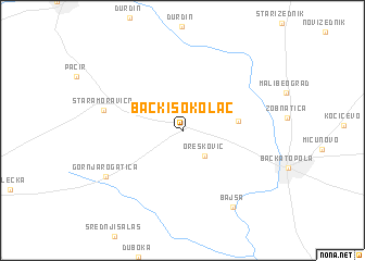
Bački Sokolac (Srbija, Serbia and Montenegro)Bački Sokolac is a town in the Srbija region of Serbia and Montenegro. An overview map of the region around Bački Sokolac is displayed below.
regional and 3d topo map of Bački Sokolac, Serbia and Montenegro ::
Bački Sokolac airports ::
The nearest airport is OSI - Osijek, located 71.3 km south west of Bački Sokolac.
Other airports nearby include BEG - Beograd (129.5 km south east), ARW - Arad (138.3 km east), TSR - Timisoara Traian Vuia (139.8 km east), BUD - Budapest Ferihegy (177.8 km north), Nearby towns ::
Orešković (3.0km south east) //
Karađorđevo (4.1km east) //
Stara Moravica (6.1km west) //
Gornja Rogatica (7.2km south west) //
Bajša (8.6km south east) //
[all distances 'as the bird flies' and approximate] 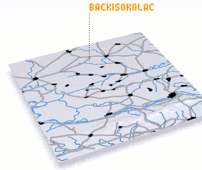 Places with similar names to Bački Sokolac, Serbia and Montenegro ::
// Bokšić Lug (HR)
Disclaimer :: Information on this page comes without warranty of any kind |
||
|
Where is Bački Sokolac? Elevation and coordinates ::
Latitude (lat): 45°50'58"N Longitude (lon): 19°32'22"E
Elevation (approx.): 104m (map arrows pan, magnifying glasses zoom) |
||
|
Visiting Bački Sokolac? Hotel/Accommodation ::
Book a hotel in Bački Sokolac Travel Guide ::
rental cars ::
car rental offers GPS waypoint ::
download a GPX waypoint (PoI) of Bački Sokolac for your GPS receiver
|
||