|
search place name
|
||
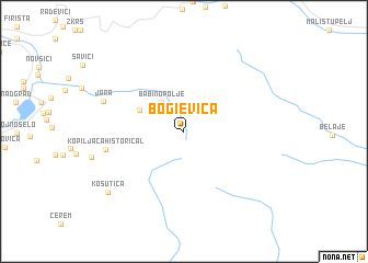
Bogi°evica (Crna Gora, Serbia and Montenegro)Bogi°evica is a town in the Crna Gora region of Serbia and Montenegro. An overview map of the region around Bogi°evica is displayed below.
regional and 3d topo map of Bogi°evica, Serbia and Montenegro ::
Bogi°evica airports ::
The nearest airport is TGD - Podgorica, located 71.9 km west of Bogi°evica.
Other airports nearby include PRN - Pristina (79.0 km east), TIV - Tivat (112.7 km west), TIA - Tirana Rinas (132.7 km south), SKP - Skopje (144.9 km south east), Nearby towns ::
Babino Polje (3.4km north west) //
Dubočak [historical] (4.0km north west) //
Kopiljača [historical] (6.1km west) //
Jara (6.8km north west) //
Košutica (8.5km south west) //
[all distances 'as the bird flies' and approximate] 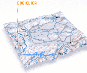 Places with similar names to Bogi°evica, Serbia and Montenegro ::
Disclaimer :: Information on this page comes without warranty of any kind |
||
|
Where is Bogi°evica? Elevation and coordinates ::
Latitude (lat): 42°34'48"N Longitude (lon): 20°4'27"E
Elevation (approx.): 1794m (map arrows pan, magnifying glasses zoom) |
||
|
Visiting Bogi°evica? Hotel/Accommodation ::
Book a hotel in Bogi°evica Travel Guide ::
rental cars ::
car rental offers GPS waypoint ::
download a GPX waypoint (PoI) of Bogi°evica for your GPS receiver
|
||