|
search place name
|
||
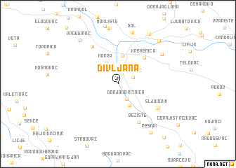
Divljana (Srbija, Serbia and Montenegro)Divljana is a town in the Srbija region of Serbia and Montenegro. An overview map of the region around Divljana is displayed below.
regional and 3d topo map of Divljana, Serbia and Montenegro ::
Divljana airports ::
The nearest airport is INI - Nis, located 40.7 km north west of Divljana.
Other airports nearby include SOF - Sofia (104.7 km south east), PRN - Pristina (123.5 km south west), SKP - Skopje (146.2 km south west), CRA - Craiova (179.9 km north east), Nearby towns ::
Oreovac (2.0km north east) //
Donja Koritnica (2.6km south east) //
Mokra (3.6km north) //
Gornja Koritnica (3.7km south) //
Bela Palanka (4.6km north) //
Kremenica (5.2km north east) //
Bežište (6.5km south) //
Novo Selo (6.7km north west) //
Šljivovik (6.0km south east) //
Klisura (6.9km north east) //
Dol (8.4km north) //
Moklište (8.9km north) //
Vrgudinac (8.3km north west) //
Resnik (8.7km south east) //
Bukurovac (8.8km north east) //
Klenje (8.3km north east) //
Bratiševac (10.1km south east) //
[all distances 'as the bird flies' and approximate] 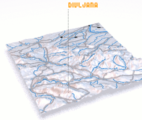 Places with similar names to Divljana, Serbia and Montenegro :: Disclaimer :: Information on this page comes without warranty of any kind |
||
|
Where is Divljana? Elevation and coordinates ::
Latitude (lat): 43°10'38"N Longitude (lon): 22°18'16"E
Elevation (approx.): 350m (map arrows pan, magnifying glasses zoom) |
||
|
Visiting Divljana? Hotel/Accommodation ::
Book a hotel in Divljana Travel Guide ::
rental cars ::
car rental offers GPS waypoint ::
download a GPX waypoint (PoI) of Divljana for your GPS receiver
|
||