|
search place name
|
||
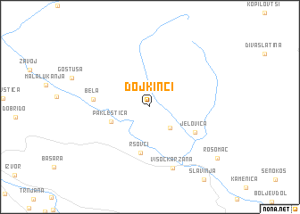
Dojkinci (Srbija, Serbia and Montenegro)Dojkinci is a town in the Srbija region of Serbia and Montenegro. An overview map of the region around Dojkinci is displayed below.
regional and 3d topo map of Dojkinci, Serbia and Montenegro ::
Dojkinci airports ::
The nearest airport is INI - Nis, located 76.6 km west of Dojkinci.
Other airports nearby include SOF - Sofia (77.7 km south east), CRA - Craiova (150.5 km north east), PRN - Pristina (160.1 km south west), SKP - Skopje (169.7 km south west), Nearby towns ::
Brlog (3.2km south east) //
Pakleštica (4.0km south west) //
Rsovci (5.8km south) //
Jelovica (5.2km south east) //
Bela (5.3km west) //
Visočka Ržana (7.9km south) //
Rosomač (8.9km south east) //
[all distances 'as the bird flies' and approximate] 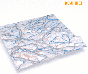 Places with similar names to Dojkinci, Serbia and Montenegro ::
// Djiguénesso (ML)
Disclaimer :: Information on this page comes without warranty of any kind |
||
|
Where is Dojkinci? Elevation and coordinates ::
Latitude (lat): 43°13'29"N Longitude (lon): 22°47'5"E
Elevation (approx.): 882m (map arrows pan, magnifying glasses zoom) |
||
|
Visiting Dojkinci? Hotel/Accommodation ::
Book a hotel in Dojkinci Travel Guide ::
rental cars ::
car rental offers GPS waypoint ::
download a GPX waypoint (PoI) of Dojkinci for your GPS receiver
|
||