|
search place name
|
||
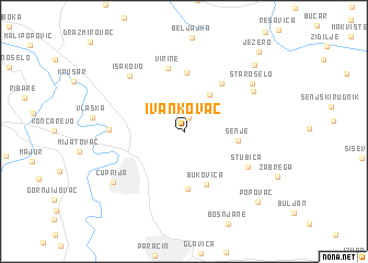
Ivankovac (Srbija, Serbia and Montenegro)Ivankovac is a town in the Srbija region of Serbia and Montenegro. An overview map of the region around Ivankovac is displayed below.
regional and 3d topo map of Ivankovac, Serbia and Montenegro ::
Ivankovac airports ::
The nearest airport is INI - Nis, located 78.4 km south east of Ivankovac.
Other airports nearby include BEG - Beograd (129.8 km north west), PRN - Pristina (159.0 km south), CSB - Caransebes (173.3 km north), TSR - Timisoara Traian Vuia (204.2 km north), Nearby towns ::
Paljane (1.4km north) //
Donje Medare (4.2km north east) //
Senje (4.0km east) //
Bukovica (5.5km south) //
Batinac (5.8km south) //
Gornje Medare (6.0km north) //
Bigrenica (5.6km north east) //
Virine (6.6km north) //
Stubica (5.8km south east) //
Supska (5.5km west) //
Isakovo (7.0km north west) //
Bigrenica (6.5km north east) //
Staro Selo (6.9km north east) //
Ćuprija (7.3km south west) //
Kovanica (8.4km north east) //
Popovac (8.9km south east) //
Jezero (9.8km north east) //
[all distances 'as the bird flies' and approximate] 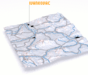 Places with similar names to Ivankovac, Serbia and Montenegro ::
Disclaimer :: Information on this page comes without warranty of any kind |
||
|
Where is Ivankovac? Elevation and coordinates ::
Latitude (lat): 43°58'25"N Longitude (lon): 21°26'5"E
Elevation (approx.): 168m (map arrows pan, magnifying glasses zoom) |
||
|
Visiting Ivankovac? Hotel/Accommodation ::
Book a hotel in Ivankovac Travel Guide ::
rental cars ::
car rental offers GPS waypoint ::
download a GPX waypoint (PoI) of Ivankovac for your GPS receiver
|
||