|
search place name
|
||
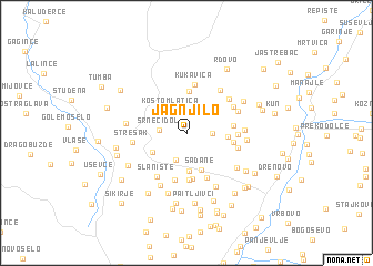
Jagnjilo (Srbija, Serbia and Montenegro)Jagnjilo is a town in the Srbija region of Serbia and Montenegro. An overview map of the region around Jagnjilo is displayed below.
regional and 3d topo map of Jagnjilo, Serbia and Montenegro ::
Jagnjilo airports ::
The nearest airport is INI - Nis, located 70.4 km north of Jagnjilo.
Other airports nearby include PRN - Pristina (77.5 km west), SKP - Skopje (87.7 km south), SOF - Sofia (118.2 km east), OHD - Ohrid (197.7 km south west), Nearby towns ::
Brestovo (1.9km east) //
Srneći Dol (2.1km west) //
Kostomlatica (2.6km north west) //
Ravna Reka (2.7km south) //
Japanci (3.8km south) //
Solačka Sena (3.2km south west) //
Sadane (3.9km south) //
Kunovo (3.0km east) //
Kukavica (4.3km north) //
Karadince (4.6km south) //
Rid (4.7km south) //
Ljubinci (3.5km east) //
Stojkovci (3.5km east) //
Beliševo (4.7km south) //
Deda-Ilinci (4.7km south) //
Kukavica (5.0km north) //
Rumenkinci (3.7km east) //
Slanište (4.9km south west) //
Klinčari (4.1km east) //
Milenkovčani (4.3km north east) //
Jabukovo (4.9km north east) //
Breza (4.7km north east) //
Strešak (4.1km west) //
Donje Jabukovo (4.4km north east) //
Kovačevci (4.3km east) //
Slaništari (5.6km south) //
Kacapun (5.0km south east) //
Marinkovci (4.5km east) //
Široka Padina (5.8km south) //
[all distances 'as the bird flies' and approximate]  Places with similar names to Jagnjilo, Serbia and Montenegro ::
Disclaimer :: Information on this page comes without warranty of any kind |
||
|
Where is Jagnjilo? Elevation and coordinates ::
Latitude (lat): 42°42'32"N Longitude (lon): 21°57'47"E
Elevation (approx.): 759m (map arrows pan, magnifying glasses zoom) |
||
|
Visiting Jagnjilo? Hotel/Accommodation ::
Book a hotel in Jagnjilo Travel Guide ::
rental cars ::
car rental offers GPS waypoint ::
download a GPX waypoint (PoI) of Jagnjilo for your GPS receiver
|
||