|
search place name
|
||
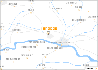
Laćarak (Srbija, Serbia and Montenegro)Laćarak is a town in the Srbija region of Serbia and Montenegro. An overview map of the region around Laćarak is displayed below.
regional and 3d topo map of Laćarak, Serbia and Montenegro ::
Laćarak airports ::
The nearest airport is BEG - Beograd, located 61.9 km east of Laćarak.
Other airports nearby include OSI - Osijek (78.5 km north west), SJJ - Sarajevo (163.8 km south west), TSR - Timisoara Traian Vuia (165.0 km north east), ARW - Arad (185.7 km north east), Nearby towns ::
Mačvanska Mitrovica (4.7km south east) //
Zasavica Druga (4.9km south west) //
Sremska Mitrovica (5.0km south east) //
Salaš Noćajski (6.1km south) //
Noćaj (8.4km south) //
Zasavica Prva (7.7km south west) //
Čalma (9.8km north west) //
Radenković (10.5km south west) //
[all distances 'as the bird flies' and approximate] 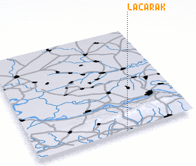 Places with similar names to Laćarak, Serbia and Montenegro ::
// Locaroc (PH)
// Lee Creek (US)
// La Correggia (IT)
// Lagariça (PT)
// La Carraca (ES)
// Likurga (RU)
// Lucarque (EC)
// Lekuruki (TZ)
// Luguruka (TZ)
// Lakar Kūh (IR)
Disclaimer :: Information on this page comes without warranty of any kind |
||
|
Where is Laćarak? Elevation and coordinates ::
Latitude (lat): 45°0'8"N Longitude (lon): 19°34'7"E
Elevation (approx.): 81m (map arrows pan, magnifying glasses zoom) |
||
|
Visiting Laćarak? Hotel/Accommodation ::
Book a hotel in Laćarak Travel Guide ::
rental cars ::
car rental offers GPS waypoint ::
download a GPX waypoint (PoI) of Laćarak for your GPS receiver
|
||