|
search place name
|
||
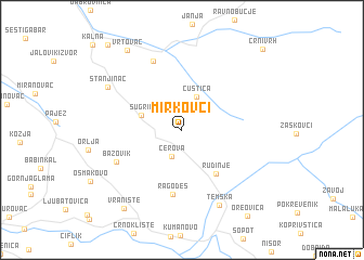
Mirkovci (Srbija, Serbia and Montenegro)Mirkovci is a town in the Srbija region of Serbia and Montenegro. An overview map of the region around Mirkovci is displayed below.
regional and 3d topo map of Mirkovci, Serbia and Montenegro ::
Mirkovci airports ::
The nearest airport is INI - Nis, located 53.2 km west of Mirkovci.
Other airports nearby include SOF - Sofia (101.6 km south east), PRN - Pristina (146.8 km south west), CRA - Craiova (156.0 km north east), SKP - Skopje (168.6 km south west), Nearby towns ::
Cerova (2.8km south) //
Ćuštica (3.6km north) //
Šugrin (3.4km north west) //
Rudinje (5.2km south east) //
Ragodeš (6.6km south) //
Bazovik (5.9km south west) //
Balta Berilovac (7.4km north) //
Temska (8.2km south) //
Stanjinac (7.1km north west) //
Vrtovac (9.1km north west) //
Vranište (9.1km south west) //
Oreovica (10.1km south east) //
Inovo (10.4km north west) //
Crni Vrh (10.3km north east) //
[all distances 'as the bird flies' and approximate]  Places with similar names to Mirkovci, Serbia and Montenegro ::
Disclaimer :: Information on this page comes without warranty of any kind |
||
|
Where is Mirkovci? Elevation and coordinates ::
Latitude (lat): 43°19'49"N Longitude (lon): 22°30'35"E
Elevation (approx.): 860m (map arrows pan, magnifying glasses zoom) |
||
|
Visiting Mirkovci? Hotel/Accommodation ::
Book a hotel in Mirkovci Travel Guide ::
rental cars ::
car rental offers GPS waypoint ::
download a GPX waypoint (PoI) of Mirkovci for your GPS receiver
|
||