|
search place name
|
||
Mužinac (Srbija, Serbia and Montenegro)Mužinac is a town in the Srbija region of Serbia and Montenegro. An overview map of the region around Mužinac is displayed below.
regional and 3d topo map of Mužinac, Serbia and Montenegro ::

Mužinac airports ::
The nearest airport is INI - Nis, located 41.4 km south of Mužinac.
Other airports nearby include PRN - Pristina (142.8 km south west), SOF - Sofia (169.3 km south east), BEG - Beograd (174.2 km north west), CSB - Caransebes (192.6 km north), Nearby towns ::
Gornja Mala (2.2km west) //
Selište (2.3km west) //
Šarbanovac (2.5km east) //
Trgovište (3.2km south west) //
Vrmdža (2.7km west) //
Beli Potok (4.4km south) //
Vlaško Selo (3.8km west) //
Žučkovac (5.1km south west) //
Soko Banja (7.6km south) //
Nikolinac (6.0km south east) //
Čučunje (8.0km south) //
Jošanica (6.7km west) //
Lepterija (8.7km south) //
Resnik (8.7km south west) //
Blendija (8.4km south east) //
Poružnica (9.5km south west) //
[all distances 'as the bird flies' and approximate] 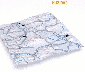 Places with similar names to Mužinac, Serbia and Montenegro ::
Disclaimer :: Information on this page comes without warranty of any kind |
||
|
Where is Mužinac? Elevation and coordinates ::
Latitude (lat): 43°42'37"N Longitude (lon): 21°51'10"E
Elevation (approx.): 509m (map arrows pan, magnifying glasses zoom) |
||
|
Visiting Mužinac? Hotel/Accommodation ::
Book a hotel in Mužinac Travel Guide ::
rental cars ::
car rental offers GPS waypoint ::
download a GPX waypoint (PoI) of Mužinac for your GPS receiver
|
||