|
search place name
|
||
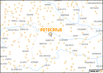
Potočanje (Srbija, Serbia and Montenegro)Potočanje is a town in the Srbija region of Serbia and Montenegro. An overview map of the region around Potočanje is displayed below.
regional and 3d topo map of Potočanje, Serbia and Montenegro ::
Potočanje airports ::
The nearest airport is BEG - Beograd, located 115.3 km north of Potočanje.
Other airports nearby include SJJ - Sarajevo (127.1 km west), INI - Nis (165.9 km east), PRN - Pristina (166.1 km south east), TGD - Podgorica (171.0 km south), Nearby towns ::
Krvavci (1.0km south east) //
Subotići (2.6km south) //
Rujevac (2.3km north west) //
Gorjani (2.2km east) //
Sevojno (2.9km north) //
Mladovo (3.3km north) //
Potpeće (3.0km south east) //
Ršumovići (3.0km north east) //
Zaboj (4.1km south) //
Drežnik (4.7km south) //
Obućini (4.3km south west) //
Lokva (4.8km north) //
Vukotići (4.7km south) //
Vlaovac (4.5km north west) //
Zlakusa (4.0km south east) //
Gajevi (3.8km west) //
Krčagovo (4.3km north west) //
Ponikovica (5.5km north) //
Tomići (5.1km north east) //
Tvrdići (5.5km north east) //
Lazovina (5.5km north west) //
Citići (4.6km west) //
Savići (6.2km south west) //
Tatinac (6.7km north) //
Markovići (6.2km south east) //
Zbojštica (5.6km south west) //
Skržuti (6.7km south west) //
Tatinac (6.5km north west) //
Radovci (5.5km east) //
[all distances 'as the bird flies' and approximate]  Places with similar names to Potočanje, Serbia and Montenegro ::
Disclaimer :: Information on this page comes without warranty of any kind |
||
|
Where is Potočanje? Elevation and coordinates ::
Latitude (lat): 43°49'14"N Longitude (lon): 19°54'39"E
Elevation (approx.): 414m (map arrows pan, magnifying glasses zoom) |
||
|
Visiting Potočanje? Hotel/Accommodation ::
Book a hotel in Potočanje Travel Guide ::
rental cars ::
car rental offers GPS waypoint ::
download a GPX waypoint (PoI) of Potočanje for your GPS receiver
|
||