|
search place name
|
||
Šimanovci (Srbija, Serbia and Montenegro)Šimanovci is a town in the Srbija region of Serbia and Montenegro. An overview map of the region around Šimanovci is displayed below.
regional and 3d topo map of Šimanovci, Serbia and Montenegro ::

Šimanovci airports ::
The nearest airport is BEG - Beograd, located 18.2 km east of Šimanovci.
Other airports nearby include OSI - Osijek (120.2 km north west), TSR - Timisoara Traian Vuia (142.8 km north east), ARW - Arad (171.4 km north east), SJJ - Sarajevo (182.4 km south west), Nearby towns ::
Deč (4.4km south east) //
Krnješevci (3.8km north east) //
Sremski Mihaljevci (4.0km south west) //
Karlovči° (6.4km south west) //
Vojka (8.9km north east) //
Petrovičić (9.7km south east) //
Popinci (8.7km north west) //
[all distances 'as the bird flies' and approximate] 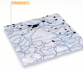 Places with similar names to Šimanovci, Serbia and Montenegro ::
// Ćemanovići (BA)
// Cemanovići (BA)
// Šahmanovići (BA)
// Šemenovci (BA)
// Simanovići (BA)
// Šimunovići (BA)
// Simunovići (BA)
// Simunovići (BA)
// (( Simonovići )) (CS)
// Semněvice (CZ)
Disclaimer :: Information on this page comes without warranty of any kind |
||
|
Where is Šimanovci? Elevation and coordinates ::
Latitude (lat): 44°52'21"N Longitude (lon): 20°5'30"E
Elevation (approx.): 75m (map arrows pan, magnifying glasses zoom) |
||
|
Visiting Šimanovci? Hotel/Accommodation ::
Book a hotel in Šimanovci Travel Guide ::
rental cars ::
car rental offers GPS waypoint ::
download a GPX waypoint (PoI) of Šimanovci for your GPS receiver
|
||