|
search place name
|
||
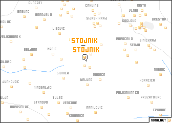
Stojnik (Srbija, Serbia and Montenegro)Stojnik is a town in the Srbija region of Serbia and Montenegro. An overview map of the region around Stojnik is displayed below.
regional and 3d topo map of Stojnik, Serbia and Montenegro ::
Stojnik airports ::
The nearest airport is BEG - Beograd, located 38.7 km north west of Stojnik.
Other airports nearby include TSR - Timisoara Traian Vuia (160.1 km north east), INI - Nis (168.8 km south east), OSI - Osijek (170.9 km north west), CSB - Caransebes (172.3 km north east), Nearby towns ::
Dučina (1.0km south) //
Rovače (1.4km south east) //
Hajdukovački Kraj (1.8km north east) //
Stojnik (2.1km north) //
Mala Mlaka (4.3km north) //
Babe (4.3km north east) //
Rogača (4.5km south east) //
Drlupa (5.1km south) //
Slatina (3.9km west) //
Guberevac (5.3km north west) //
Sibnica (5.0km south west) //
Manić (5.4km west) //
Brđani (7.8km north) //
Parcani (8.0km north) //
Lisović (7.3km north west) //
Mala Polja (8.4km north) //
Šijaški Kraj (8.5km north) //
Sopot (6.5km east) //
Ropočevo (7.2km north east) //
Ralja (9.8km north east) //
[all distances 'as the bird flies' and approximate]  Places with similar names to Stojnik, Serbia and Montenegro ::
// Stegienka (PL)
// Sot'aejŏng (KR)
// Situojing (CN)
// Xiadujiang (CN)
// Stajnica (HR)
// Stojnik (CS)
// Stojnik (CS)
Disclaimer :: Information on this page comes without warranty of any kind |
||
|
Where is Stojnik? Elevation and coordinates ::
Latitude (lat): 44°29'51"N Longitude (lon): 20°29'52"E
Elevation (approx.): 186m (map arrows pan, magnifying glasses zoom) |
||
|
Visiting Stojnik? Hotel/Accommodation ::
Book a hotel in Stojnik Travel Guide ::
rental cars ::
car rental offers GPS waypoint ::
download a GPX waypoint (PoI) of Stojnik for your GPS receiver
|
||