|
search place name
|
||
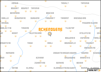
Acherodene (Chaouen, Morocco)Acherodene is a town in the Chaouen region of Morocco. An overview map of the region around Acherodene is displayed below.
regional and 3d topo map of Acherodene, Morocco ::
Acherodene airports ::
The nearest airport is TTU - Tetouan Saniat Rmel, located 88.9 km north west of Acherodene.
Other airports nearby include AHU - Al Hociema Cherif El Idrissi (95.7 km east), FEZ - Fez Saiss (108.7 km south), MEK - Meknes Bassatine (129.4 km south west), TNG - Tanger Ibn Batouta (134.6 km north west), Nearby towns ::
Assalli (2.4km south west) //
Isalgene (2.4km north west) //
Mahli (3.7km south) //
Haddaka (3.0km west) //
Dar Amekouil (4.0km south) //
El Mikafa (3.6km north east) //
Talamouksa (3.6km south east) //
Iboutane (3.6km north west) //
Talʼat Rihane (4.6km west) //
Talarihane (4.6km west) //
Taourart (5.6km north) //
Azemour (5.8km north) //
Bou Chia (7.4km north) //
Bou Jemaa (6.4km east) //
Tiloutaf (6.4km east) //
Mesgane (6.4km west) //
Tamorot (7.2km north east) //
Ouadiene (7.2km north west) //
Bou Soumla (7.1km south east) //
Taïda (7.1km south west) //
Zaouiet Ahmed es Sounni (8.7km south east) //
[all distances 'as the bird flies' and approximate] 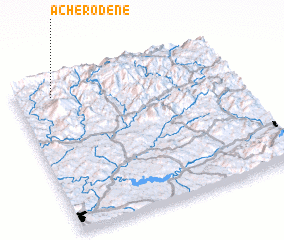 Places with similar names to Acherodene, Morocco ::
Disclaimer :: Information on this page comes without warranty of any kind |
||
|
Where is Acherodene? Elevation and coordinates ::
Latitude (lat): 34°54'0"N Longitude (lon): 4°50'0"W
Elevation (approx.): 1069m (map arrows pan, magnifying glasses zoom) |
||
|
Visiting Acherodene? Hotel/Accommodation ::
Book a hotel in Acherodene Travel Guide ::
Buy a travel guide for Morocco rental cars ::
car rental offers GPS waypoint ::
download a GPX waypoint (PoI) of Acherodene for your GPS receiver
|
||