|
search place name
|
||
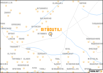
Aït Boutili (Taroudannt, Morocco)Aït Boutili is a town in the Taroudannt region of Morocco. An overview map of the region around Aït Boutili is displayed below.
regional and 3d topo map of Aït Boutili, Morocco ::
Aït Boutili airports ::
The nearest airport is AGA - Agadir Inezgane, located 53.2 km west of Aït Boutili.
Other airports nearby include RAK - Marrakech Menara (173.4 km north east), Nearby towns ::
Aït Abbes (2.8km west) //
Dar Douiou (3.8km north) //
El Faïda (3.9km north west) //
Oulad Raho (5.7km north) //
Oulad Mohammed (5.6km north west) //
Aït Kacem (5.3km north west) //
Nbika (6.0km west) //
Oumsdikt (8.0km south) //
Issil (7.7km south east) //
Douar el Kebir (8.3km north) //
Amchtoutel (8.5km south) //
El Aassela (7.5km west) //
El Khemis (8.4km south west) //
Imi Ougadir (8.7km south west) //
Banoun (9.3km south west) //
Touasjout (9.1km south east) //
Tifrelt (9.1km south east) //
Tidsi (9.2km south west) //
[all distances 'as the bird flies' and approximate] 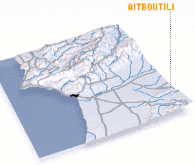 Places with similar names to Aït Boutili, Morocco ::
// Adabatelo (MG)
// Adabotelo (MG)
// Ādibatla (IN)
// Adabaï Deïli (MR)
// Aït Abdallah (MA)
// Aït Abdallah (MA)
// Aït Abdallah (MA)
// Aït Abdallah (MA)
// Aït Abdelli (MA)
// Aït Abdallah (DZ)
Disclaimer :: Information on this page comes without warranty of any kind |
||
|
Where is Aït Boutili? Elevation and coordinates ::
Latitude (lat): 30°17'2"N Longitude (lon): 9°0'16"W
Elevation (approx.): 243m (map arrows pan, magnifying glasses zoom) |
||
|
Visiting Aït Boutili? Hotel/Accommodation ::
Book a hotel in Aït Boutili Travel Guide ::
Buy a travel guide for Morocco rental cars ::
car rental offers GPS waypoint ::
download a GPX waypoint (PoI) of Aït Boutili for your GPS receiver
|
||