|
search place name
|
||
Aït Driss (Tiznit, Morocco)Aït Driss is a town in the Tiznit region of Morocco. An overview map of the region around Aït Driss is displayed below.
regional and 3d topo map of Aït Driss, Morocco ::

Aït Driss airports ::
The nearest airport is AGA - Agadir Inezgane, located 114.1 km north east of Aït Driss.
Other airports nearby include TTA - Tan Tan Plage Blanche (155.1 km south west), TIN - Tindouf (267.4 km south east), Nearby towns ::
Hancrir (0.0km north) //
Timgrat (1.6km east) //
Tahkakout (1.6km west) //
Belsak (1.9km north) //
Sidi Aïssa (2.5km south east) //
Id Ou Asto (2.5km south west) //
Id Baknia (2.5km north east) //
Sidi el Makar (2.5km north west) //
Id Ali Ou Mohand (3.2km west) //
Sidi Beljer (3.7km south) //
Tazarine (3.2km west) //
Moulay Ihia (3.7km south) //
Id Yuaiga (3.7km south) //
Sidi Mohand (3.2km east) //
Id Ali Ufla (3.2km east) //
Dar Tiguigur (3.7km north) //
Sidi Bou nʼKenadi (3.7km north) //
Id Ougni (3.7km south west) //
Iyauan (3.7km north west) //
Cheïkh Amma (3.7km south east) //
Id Brahim Mohamed (3.7km north west) //
Sidi Ali Ou Aomar (3.7km north east) //
Sidi Bou Kenadi (4.0km north west) //
Id Abú (4.0km north west) //
Borch en Id Abú (4.0km north west) //
Sidi Mohammed Ou Ali (4.0km north east) //
Ferrecric (4.0km north east) //
Id Burás (4.0km north east) //
Id Bidern (4.0km north east) //
[all distances 'as the bird flies' and approximate] 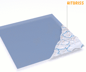 Places with similar names to Aït Driss, Morocco ::
// Ātdarrahsī (IR)
// Ātdarrahsī (IR)
// Aït Dris (MA)
// Aït Dris (MA)
// Aït Driss (MA)
// Aït Driss (MA)
Disclaimer :: Information on this page comes without warranty of any kind |
||
|
Where is Aït Driss? Elevation and coordinates ::
Latitude (lat): 29°27'0"N Longitude (lon): 10°3'0"W
Elevation (approx.): 445m (map arrows pan, magnifying glasses zoom) |
||
|
Visiting Aït Driss? Hotel/Accommodation ::
Book a hotel in Aït Driss Travel Guide ::
Buy a travel guide for Morocco rental cars ::
car rental offers GPS waypoint ::
download a GPX waypoint (PoI) of Aït Driss for your GPS receiver
|
||