|
search place name
|
||
Aït Hadi (Marrakech, Morocco)Aït Hadi is a town in the Marrakech region of Morocco. An overview map of the region around Aït Hadi is displayed below.
regional and 3d topo map of Aït Hadi, Morocco ::

Aït Hadi airports ::
The nearest airport is RAK - Marrakech Menara, located 73.9 km east of Aït Hadi.
Other airports nearby include AGA - Agadir Inezgane (134.4 km south west), OZZ - Ouarzazate (184.7 km east), CMN - Casablanca Mohammed V Intl (245.5 km north east), Nearby towns ::
Cherkaoua (3.3km north east) //
Tigajnine (3.8km north) //
Siad (4.4km north) //
Oulad Bou Annga (3.8km east) //
El Aonafra (4.9km south) //
El Aouamer (4.9km south east) //
Douar Ben Enfir (5.4km south east) //
El Khririba (6.0km north west) //
Oulad ez Zir (6.2km south east) //
Arib (6.6km north) //
Moulay Brahim (8.0km north) //
El Haïba (7.5km south west) //
Oulad Abd el Moula (8.6km south) //
Tamchennennt (8.2km north east) //
Rhouirgat (7.7km west) //
Sahed el Atrous (8.9km south) //
Oulad Chinnane (7.9km south west) //
Oulad Saoula (9.0km south) //
Saïdat (8.6km south east) //
Skikine (9.1km north west) //
[all distances 'as the bird flies' and approximate] 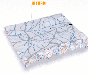 Places with similar names to Aït Hadi, Morocco ::
// Āithādi (BD)
// Aït Haddou (MA)
// Aït Haddou (MA)
// Aït Haddou (MA)
// Aït Haddou (MA)
// Aït Haddou (MA)
// Aït Haïda (MA)
// Aït Hattou (MA)
// Aït Haddou (MA)
// Aït Haddou (MA)
Disclaimer :: Information on this page comes without warranty of any kind |
||
|
Where is Aït Hadi? Elevation and coordinates ::
Latitude (lat): 31°23'39"N Longitude (lon): 8°46'23"W
Elevation (approx.): 501m (map arrows pan, magnifying glasses zoom) |
||
|
Visiting Aït Hadi? Hotel/Accommodation ::
Book a hotel in Aït Hadi Travel Guide ::
Buy a travel guide for Morocco rental cars ::
car rental offers GPS waypoint ::
download a GPX waypoint (PoI) of Aït Hadi for your GPS receiver
|
||