|
search place name
|
||
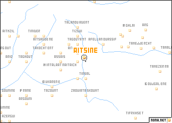
Aït Sine (Ouarzazate, Morocco)Aït Sine is a town in the Ouarzazate region of Morocco. An overview map of the region around Aït Sine is displayed below.
regional and 3d topo map of Aït Sine, Morocco ::
Aït Sine airports ::
The nearest airport is OZZ - Ouarzazate, located 74.3 km north east of Aït Sine.
Other airports nearby include RAK - Marrakech Menara (122.0 km north), AGA - Agadir Inezgane (191.4 km west), Nearby towns ::
Aït Marouf (1.6km west) //
Aït Amrane (2.4km north west) //
Tirsal (3.7km south) //
Tirselt (4.0km south west) //
Tagouyamt (4.0km north west) //
Tamenout nʼOufella (4.9km north west) //
Afella nʼ Ou Assif (4.9km north east) //
Assaïs (4.8km west) //
Imi nʼTalaat nʼAït Aïch (5.1km west) //
Tizgui (5.8km north) //
Tamenout nʼIzder (5.1km west) //
Zaouia Taskoumt (7.4km south) //
Tala nʼOuadent (7.6km north) //
Tafrent (7.4km north east) //
Ioukarene (8.5km south west) //
Tazoult (8.7km north east) //
Taloust (8.9km north east) //
Tazount (9.8km south west) //
[all distances 'as the bird flies' and approximate] 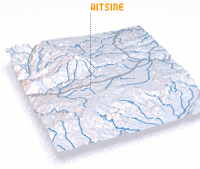 Places with similar names to Aït Sine, Morocco ::
Disclaimer :: Information on this page comes without warranty of any kind |
||
|
Where is Aït Sine? Elevation and coordinates ::
Latitude (lat): 30°35'0"N Longitude (lon): 7°34'0"W
Elevation (approx.): 1764m (map arrows pan, magnifying glasses zoom) |
||
|
Visiting Aït Sine? Hotel/Accommodation ::
Book a hotel in Aït Sine Travel Guide ::
Buy a travel guide for Morocco rental cars ::
car rental offers GPS waypoint ::
download a GPX waypoint (PoI) of Aït Sine for your GPS receiver
|
||